 Filter: Categories of Wisconsin Historical Images
Filter: County of Forest
Filter: Type of Map or Atlas
Filter: Categories of Wisconsin Historical Images
Filter: County of Forest
Filter: Type of Map or Atlas
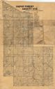
| Date: | 1908 |
|---|---|
| Description: | Map shows swamps, windfalls, roads and railroads. Status of some land marked (O, S, X) but lacks explanation. |

| Date: | 1920 |
|---|---|
| Description: | This 1920 map of Forest County, Wisconsin, shows the township and range grid, sections, cities and villages, lakes and streams, roads, "steam railroads," s... |

| Date: | 1967 |
|---|---|
| Description: | This tourist brochure for Forest County, Wisconsin, includes a 1967 road map of the county which identifies points of interest, a location map, descriptive... |

| Date: | 1919 |
|---|---|
| Description: | "Map no. 2, Keith and Hiles Lumber Co., Crandon, Wisconsin, Block Map, Block One... Made December 20, 1919. Maker of original map, B. McGinley. Maker of ta... |
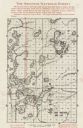
| Date: | 1935 |
|---|---|
| Description: | This map shows land for sale by the company in northwestern part of Nicolet National Forest. The map also shows shoreline acreages, railroads, roads, trail... |

| Date: | 1972 |
|---|---|
| Description: | A topographic map of the Blackwell quadrangle. |
If you didn't find the material you searched for, our Library Reference Staff can help.
Call our reference desk at 608-264-6535 or email us at: