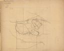
| Date: | 1875 |
|---|---|
| Description: | This manuscript map by Increase Lapham, drawn in the last year of his life, shows landownership, roads and railroads, springs, and boat houses around Ocono... |

| Date: | 1908 |
|---|---|
| Description: | A detail of a Sanborn map showing the area around North Franklin, North Blair and North Hancock Streets. |

| Date: | 1908 |
|---|---|
| Description: | A detail of a Sanborn map showing the North Blair Street area. |

| Date: | 1908 |
|---|---|
| Description: | A detail of a Madison Sanborn map that includes the University of Wisconsin Boat House, UW Gymnasium & Armory (The Red Gym), fraternity houses, and the YMC... |
If you didn't find the material you searched for, our Library Reference Staff can help.
Call our reference desk at 608-264-6535 or email us at: