 Filter: Categories of Wisconsin Historical Images
Filter: Subject of Roundhouses (Railroads)
Filter: Type of Map or Atlas
Filter: Categories of Wisconsin Historical Images
Filter: Subject of Roundhouses (Railroads)
Filter: Type of Map or Atlas
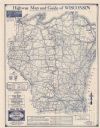
| Date: | 1930 |
|---|---|
| Description: | This map shows types of roadways, cities, lakes, rivers, county boundaries and points of interest. Included are portions of Minnesota, Iowa, Illinois, and ... |
If you didn't find the material you searched for, our Library Reference Staff can help.
Call our reference desk at 608-264-6535 or email us at:
