 Filter: Categories of Wisconsin Historical Images
Filter: Subject of Tourism
Filter: Type of Map or Atlas
Filter: Categories of Wisconsin Historical Images
Filter: Subject of Tourism
Filter: Type of Map or Atlas

| Date: | |
|---|---|
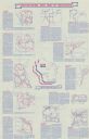
| Description: | Map reads: "Historic and Scenic Wisconsin — Land of Gathering Waters." In an inset there is a hand-painted depiction of the Wisconsin State Seal. For some ... |

| Date: | 1952 |
|---|---|
| Description: | The famous Dells of the Wisconsin River. A souvenir map embellished with bits of history and points of interest. |

| Date: | 1925 |
|---|---|
| Description: | This brochure intended for tourists and shows resorts, lakes and railroads in northwestern Wisconsin and part of Michigan’s upper peninsula. Two inset maps... |
| Date: | 1976 |
|---|---|
| Description: | Intended for tourists, the front of this guide includes twelve county bicycle maps and text. The reverse includes four maps of state trails and nine maps o... |

| Date: | 1958 |
|---|---|
| Description: | Includes images of Flambeau River State Forest and a description of, canoeing and recreational activities in, and general park and forest information about... |

| Date: | 1941 |
|---|---|
| Description: | This pictorial map of Wisconsin with historical text highlights the history of the state and identifies places of interest, Indian villages, missions, trad... |

| Date: | 1909 |
|---|---|
| Description: | A brochure with a map showing the North-Western Railway lines from northern Illinois, starting at Chicago, to southeastern Wisconsin, stopping at Sheboygan... |

| Date: | 1941 |
|---|---|
| Description: | A map of the area south of Ripon and Sheboygan and east of Waterloo and Janesville, showing the route of the Chicago, North Shore and Milwaukee Railroad in... |
| Date: | 1956 |
|---|---|
| Description: | A map that identifies the trout lakes in Wisconsin and their proximity to cities. Text on the page of the map highlights the conservation actions taken by ... |

| Date: | 1936 |
|---|---|
| Description: | This pictorial tourist map from the Wisconsin Conservation Commission depicts vacation activities and identifies tourist destinations throughout the state.... |

| Date: | 1950 |
|---|---|
| Description: | This road map shows federal, state and county roads in Wisconsin, northern Illinois, northeastern Iowa, eastern Minnesota, and the western portion of Michi... |

| Date: | 1904 |
|---|---|
| Description: | A brochure for the lake region of north-eastern Illinois and south-eastern Wisconsin providing information on summer activities and places to stay in the a... |

| Date: | 1975 |
|---|---|
| Description: | A tourist map of Grant County that displays the various activities and attractions found in the cities throughout the county, such as boat landings, fishin... |

| Date: | |
|---|---|
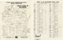
| Description: | A map of Iron County, Wisconsin, shows color-coded townships, sections, lakes and streams, villages, railroads, roads, tourist camps, and La Pointe and Lac... |

| Date: | 1900 |
|---|---|
| Description: | A map of Jefferson County, Wisconsin, that identifies named hills, other points of interest, and the Lake Mills moraine system in the county and identifies... |

| Date: | 1947 |
|---|---|
| Description: | An ink on paper, hand-drawn map of Jefferson County, Wisconsin, that identifies named hills, other points of interest, and the Lake Mills moraine system in... |

| Date: | |
|---|---|
| Description: | A brochure and map of Jefferson County, Wisconsin, which includes color illustrations, a highway map of the county, a location map, and descriptions of poi... |

| Date: | |
|---|---|
| Description: | A brochure and map of Jefferson County, Wisconsin, that includes illustrations and a location map. Descriptions of points of interest are printed on the op... |

| Date: | 1970 |
|---|---|
| Description: | A map of parks of Kewaunee County, Wisconsin, showing the fishing spots, lakes and parks in the area, it also provides a location map of the area. On the ... |

| Date: | 1990 |
|---|---|
| Description: | A tourist map of Lafayette County, Wisconsin, that shows the locations of motels, camping, municipal parks, cheese factory tours, waysides, and golf course... |
If you didn't find the material you searched for, our Library Reference Staff can help.
Call our reference desk at 608-264-6535 or email us at: