 Filter: Creator Name of Cram, George Franklin

| Date: | 1912 |
|---|---|
| Description: | This map shows parcel zones, counties, electric lines, and railroads. Includes text and charts about parcel post regulations and laws. Also includes an ins... |
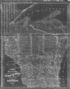
| Date: | 1900 |
|---|---|
| Description: | This map shows county boundaries, towns, waterways,towns, railroads and proposed railroads, Lake Michigan and Superior. A Portion of Michigan is visible. O... |
If you didn't find the material you searched for, our Library Reference Staff can help.
Call our reference desk at 608-264-6535 or email us at: