 Filter: Community of Minong
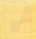
| Date: | 1900 |
|---|---|
| Description: | This map of Minong shows township 42 north platted and area R12 west. The streets are labeled. |
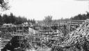
| Date: | 1936 |
|---|---|
| Description: | Two groups of men are standing on a temporary wooden bridge over the Totogatic River. There is a large form in place on the left and a complete concrete wi... |
If you didn't find the material you searched for, our Library Reference Staff can help.
Call our reference desk at 608-264-6535 or email us at: