Map or Atlas
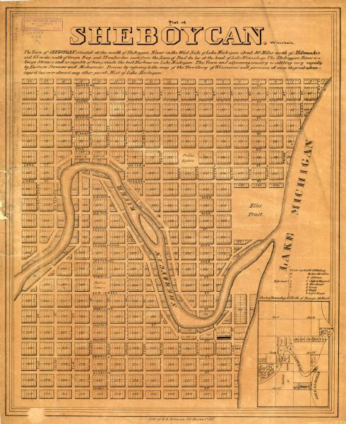
Plat of Sheboygan Wisconsin

| This is a plat map of Sheboygan showing the Sheboygan River and Lake Michigan. Streets are labeled and plats are numbered in quadrants. Some points of interest such as "Public Square" and "Ellis Tract." are also labeled. An inset map on the bottom right shows "Part of Township 15 North of Range 23 East". The top of the map reads: "The Town of SHEBOYGAN situated at the mouth of Sheboygan River on the West Side of Lake Michigan about 50 Miles north of Milwaukie and 65 miles south of Green Bay, and 33 miles due east from the Town of Fond du lac at the head of Lake Winnebago. The Sheboygan River is a large Stream and is capable of being made the best Harbour on Lake Michigan. The Town and adjoining country is selling very rapidly by Eastern Farmers and Merchants. Persons by referring to the map of the Territory of Wisconsin will perceive at once the great advantages it has over almost any other point, West of Lake Michigan." |
| Image ID: | 103261 |
|---|---|
| Creation Date: | circa 1840 |
| Creator Name: | Unknown |
| City: | Sheboygan |
| County: | Sheboygan |
| State: | Wisconsin |
| Collection Name: | Map Collection |
| Genre: | Map or Atlas |
| Original Format Type: | prints, photomechanical |
| Original Format Number: | GX9029 S53 R |
| Original Dimensions: | 55 x 45 cm., on sheet 60 x 49 cm. |
| Cities and towns |
| Land |
| Streets |
| Michigan, Lake |
| Rivers |
| This image is issued by the Wisconsin Historical Society. Use of the image requires written permission from the staff of the Collections Division. It may not be sold or redistributed, copied or distributed as a photograph, electronic file, or any other media. The image should not be significantly altered through conventional or electronic means. Images altered beyond standard cropping and resizing require further negotiation with a staff member. The user is responsible for all issues of copyright. Please Credit: Wisconsin Historical Society. |
| Location: | Wisconsin Historical Society Archives, 4th Floor, Madison, Wisconsin |
|---|
