Map or Atlas
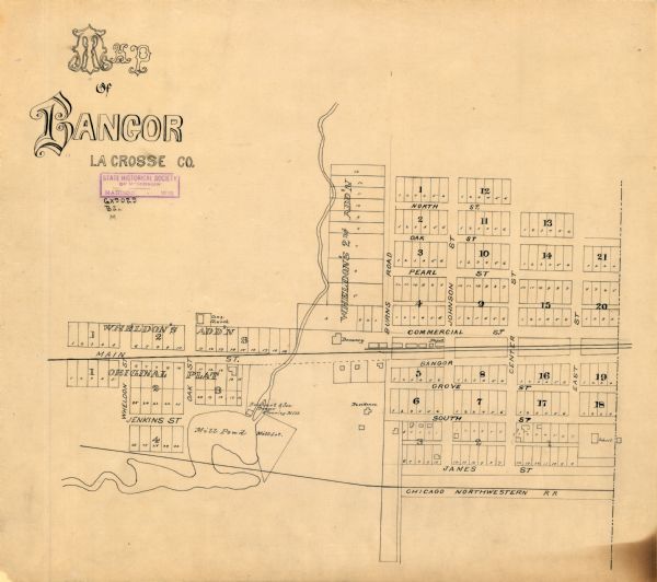
Map of Bangor, La Crosse County

| This map of Bangor is ink and pencil on cloth. The map shows roads, railroads, residences, mills, the original plat of Bangor, and the Wisconsin and Wheldon’s additions. |
| Image ID: | 103701 |
|---|---|
| Creation Date: | after 1900 |
| Creator Name: | Unknown |
| City: | Bangor |
| County: | La Crosse |
| State: | Wisconsin |
| Collection Name: | Map Collection |
| Genre: | Map or Atlas |
| Original Format Type: | drawings |
| Original Format Number: | GX9029 B21 M |
| Original Dimensions: | 40 x 43 cm., on sheet 43 x 49 cm. |
| Streets |
| Ponds |
| Railroads |
| Roads |
| Land |
| Rivers |
| Cities and towns |
| This image is issued by the Wisconsin Historical Society. Use of the image requires written permission from the staff of the Collections Division. It may not be sold or redistributed, copied or distributed as a photograph, electronic file, or any other media. The image should not be significantly altered through conventional or electronic means. Images altered beyond standard cropping and resizing require further negotiation with a staff member. The user is responsible for all issues of copyright. Please Credit: Wisconsin Historical Society. |
| Location: | Wisconsin Historical Society Archives, 4th Floor, Madison, Wisconsin |
|---|
