Map or Atlas
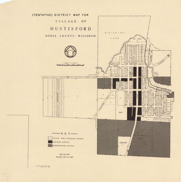
(Tentative) District Map for Village of Hustisford, Dodge County, Wisconsin

| This map shows single family residence district, business district, and manufacturing district, as well as block and lot numbers, Hustis Homestead, gravel pit, bridge, dam, park, and a cemetery. Sinissippi Lake is labeled as are streets. The middle of the map includes a key of land use. The bottom left of the map reads: "Base map traced March 1955 ; revised Sept. 1956." |
| Image ID: | 114686 |
|---|---|
| Creation Date: | 11 15 1957 |
| Creator Name: | Unknown |
| City: | Hustisford |
| County: | Dodge |
| State: | Wisconsin |
| Collection Name: | Map Collection |
| Genre: | Map or Atlas |
| Original Format Type: | prints, photomechanical |
| Original Format Number: | D GX9029 W81 M |
| Original Dimensions: | 33 x 32 cm., on sheet 44 x 43 cm. |
| Dams |
| Parks |
| Land use, Urban |
| Cemeteries |
| Cities and towns |
| Lakes |
| This image is issued by the Wisconsin Historical Society. Use of the image requires written permission from the staff of the Collections Division. It may not be sold or redistributed, copied or distributed as a photograph, electronic file, or any other media. The image should not be significantly altered through conventional or electronic means. Images altered beyond standard cropping and resizing require further negotiation with a staff member. The user is responsible for all issues of copyright. Please Credit: Wisconsin Historical Society. |
| Location: | Wisconsin Historical Society Archives, 4th Floor, Madison, Wisconsin |
|---|
