Map or Atlas
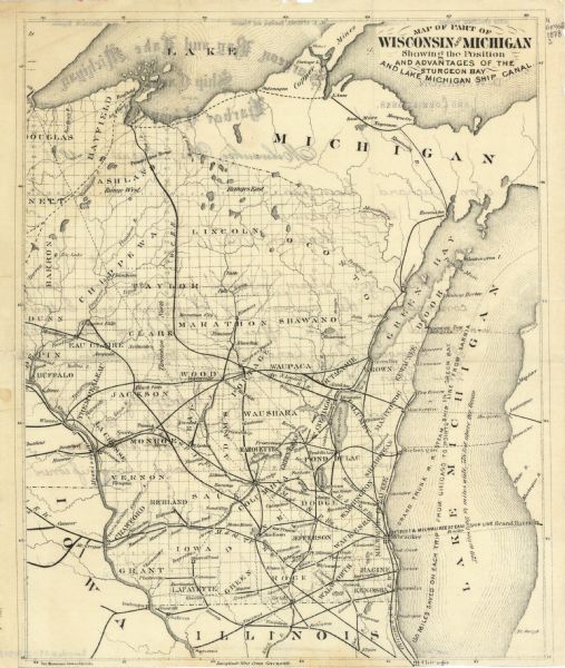
Map of Part of Wisconsin and Michigan Showing the Position and Advantages of the Sturgeon Bay and Lake Michigan Ship Canal

| This map shows the advantages of the Sturgeon Bay and Lake Michigan Ship Canal, railroads, steamship lines across Lake Michigan, and Wisconsin township grid. Portions Of Michigan, Iowa and Illinois are visible. The back of the map shows the letterhead for Sturgeon Bay and Lake Michigan Ship Canal and Harbor Company. The original cation reads, "Richard Guenther State Treasurer, Madison Wis. Sir, Will you please inform me at your early convenience the amount of principal and interest received by your office on each of the sales of Sturgeon Bay Canal lands, made under Chapter 224 laws of 1876. and office? Very Respectfully your obdt servant, D.W Mcexon Land Leammipioner." |
| Image ID: | 119894 |
|---|---|
| Creation Date: | circa 1878 |
| Creator Name: | Sturgeon Bay and Lake Michigan Ship Canal and Harbor Company |
| City: | |
| County: | |
| State: | Wisconsin |
| Collection Name: | Map Collection |
| Genre: | Map or Atlas |
| Original Format Type: | prints, fine-art |
| Original Format Number: | H GX902 1878 S |
| Original Dimensions: | 27 x 22 cm, on sheet 29 x 24 cm |
| To view the entire map see Maps and Atlases in Our Collections. |
| Cities and towns |
| Canals |
| Railroads |
| Steamboats |
| Lakes |
| Michigan, Lake |
| Rivers |
| This image is issued by the Wisconsin Historical Society. Use of the image requires written permission from the staff of the Collections Division. It may not be sold or redistributed, copied or distributed as a photograph, electronic file, or any other media. The image should not be significantly altered through conventional or electronic means. Images altered beyond standard cropping and resizing require further negotiation with a staff member. The user is responsible for all issues of copyright. Please Credit: Wisconsin Historical Society. |
| Location: | Wisconsin Historical Society Archives, 4th Floor, Madison, Wisconsin |
|---|
