Map or Atlas
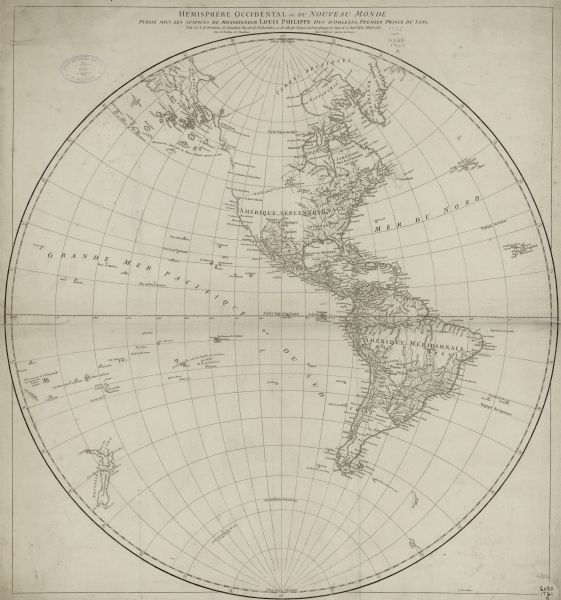
Hemisphere Occidental ou du Nouveau Monde: Publié sous les Auspices de Monseigneur Louis Philippe, duc d'Orléans, Premier Prince du Sang

| This map shows the western hemisphere. Much of the north-west coast of North America is left blank, but the rest of the map lists the names of rivers, cities, regions and montains. Unlike many of his contemporaries, d'Anville used decoration and annotation sparingly if at all as this map demonstrates. A note near the islands off the coast of Alaska and north-western Canada reads "discoveries made by the Russian for about 20 years." |
| Image ID: | 123146 |
|---|---|
| Creation Date: | 1761 |
| Creator Name: | Anville, Jean Baptiste Bourguignon d’, 1697-1782 |
| City: | |
| County: | |
| State: | |
| Collection Name: | Map Collection |
| Genre: | Map or Atlas |
| Original Format Type: | prints, fine-art |
| Original Format Number: | D GX80 1761 A |
| Original Dimensions: | 61 cm. in diam., on sheet 67 x 63 cm |
| Appears in: d'Anville's Atlas General, Paris: 1743-1767. See image ID: 123211 for a later, updated edition. |
| Rivers |
| Ocean |
| Engraving |
| Cities and towns |
| Mountains |
| Discovery and exploration |
| This image is issued by the Wisconsin Historical Society. Use of the image requires written permission from the staff of the Collections Division. It may not be sold or redistributed, copied or distributed as a photograph, electronic file, or any other media. The image should not be significantly altered through conventional or electronic means. Images altered beyond standard cropping and resizing require further negotiation with a staff member. The user is responsible for all issues of copyright. Please Credit: Wisconsin Historical Society. |
| Location: | Wisconsin Historical Society Archives, 4th Floor, Madison, Wisconsin |
|---|
