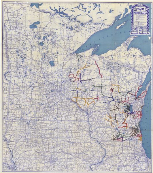
| This map shows the entire state of Wisconsin and Minnesota and portions of Illinois and Iowa. Counties, cities, highways, lakes, and rivers are labeled. Routes throughout Wisconsin have been added by hand in red, yellow, black, blue, purple, yellow, and green. The back of the map includes an extensive index of cities, towns, hotels, and garages. The bottom portion of the back includes numbered inset map of: Sioux Falls, South Dakota; Grand Forks, North Dakota; Mankato, Minnesota; Milwaukee, Wisconsin; Racine, Wisconsin; La Crosse, Wisconsin; Baraboo, Wisconsin; Aurora, Illinois; Elgin, Illinois; La Salle, Illinois; Ottumwa, Iowa; Rockford, Illinois; Waukegan, Illinois; Kenosha, Wisconsin; Moorhead, Minnesota; Madison, Wisconsin; Rochelle, Illinois; Marshalltown, Iowa; Ft. Dodge, Iowa; Waterloo, Iowa; Janesville, Wisconsin; Dubuque, Iowa; Evanston, Illinois; Minneapolis, Minnesota; Cedar Rapids, Iowa; Duluth, Minnesota; Green Bay, Wisconsin; Sioux City, Iowa; Omaha, Nebraska and Council Bluff, Iowa; Des Moines, Iowa; Davenport, Iowa and Rock Island, Moline, Illinois; St. Paul, Minnesota; and Chicago, Illinois. |

