Map or Atlas
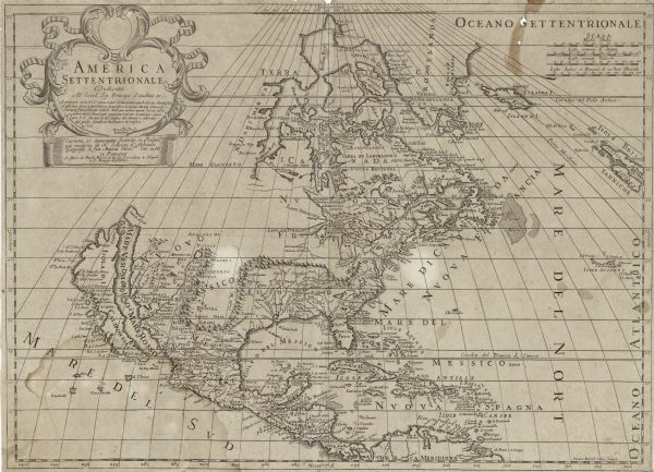
America Settentrionale: Dedicata Allèccell, sig. Principe d'Auellino etc.... Corretta, et Aumentata, Secondo le Relatione più Moderne

| Map of the north western hemisphere using sinusoidal projection to show the curvature of the earth. It labels regions, cities, Native American land, islands, rivers, lakes, and mountains. California is an island, and the Great Lakes are distorted and left open towards the west. The Appalachian mountains spread west from Lake Erie to the New Mexico region. |
| Image ID: | 123977 |
|---|---|
| Creation Date: | before 1766 |
| Creator Name: | Petrini, Paolo |
| City: | |
| County: | |
| State: | |
| Collection Name: | Map Collection |
| Genre: | Map or Atlas |
| Original Format Type: | prints, fine-art |
| Original Format Number: | H GX81 1766 S |
| Original Dimensions: | 38 x 53 cm., on sheet 40 x 55 cm |
| Italian map based upon Sanson's 1669 edition of his landmark map. |
| Engraving |
| Cities and towns |
| Maps |
| Islands |
| Mountains |
| Great Lakes (North America) |
| Lakes |
| Rivers |
| This image is issued by the Wisconsin Historical Society. Use of the image requires written permission from the staff of the Collections Division. It may not be sold or redistributed, copied or distributed as a photograph, electronic file, or any other media. The image should not be significantly altered through conventional or electronic means. Images altered beyond standard cropping and resizing require further negotiation with a staff member. The user is responsible for all issues of copyright. Please Credit: Wisconsin Historical Society. |
| Location: | Wisconsin Historical Society Archives, 4th Floor, Madison, Wisconsin |
|---|
