Photograph
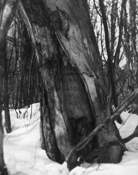
Treaty Tamarack

| Tamarack tree located in Florence County marking the beginning of the State Boundary. |
| Image ID: | 31060 |
|---|---|
| Creation Date: | circa 1940 |
| Creator Name: | Unknown |
| City: | Florence |
| County: | Florence |
| State: | Wisconsin |
| Collection Name: | Wisconsin place file, circa 1850s-circa 1950s |
| Genre: | Photograph |
| Original Format Type: | photographic print, b&w |
| Original Format Number: | PF Florence Co.1 |
| Original Dimensions: | 7.5 x 9.5 inches |
| The outcome of the Toledo War was Congress granting the Upper Peninsula to Michigan. In 1840, Captain Cram was sent by Congress to establish the boundary between Michigan and Wisconsin. Near this tree, Captain Cram made his treaty with Chief Ca-sha-o-sha, whereby the Native Americans granted permission to the United States Government to run the boundary line. However, the boundary line was not established until 1847 when W.A. Burt was sent by Congress to complete the survey. |
| Snow |
| Outdoor photography |
| Trees |
| Cities and towns |
| Signs and symbols |
| This image is issued by the Wisconsin Historical Society. Use of the image requires written permission from the staff of the Collections Division. It may not be sold or redistributed, copied or distributed as a photograph, electronic file, or any other media. The image should not be significantly altered through conventional or electronic means. Images altered beyond standard cropping and resizing require further negotiation with a staff member. The user is responsible for all issues of copyright. Please Credit: Wisconsin Historical Society. |
| Location: | Wisconsin Historical Society Archives, 4th Floor, Madison, Wisconsin |
|---|
