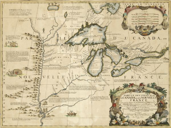
Partie occidentale du Canada ou de la Nouvelle France : ou sont les Nations des Ilinois, de Tracy, les Iroquois, et plusieurs autres peuples; avec la Louisiane nouvellement decouverte etc.

About This Image
This image is not for sale due to copyright or donor restrictions. You may be able to license it for use from its creator. Please contact us for more information:
| This map includes vignettes of Amerindian life with text describing geography, culture, and exploration activity, written in French. The Great Lakes, rivers, and landforms are labeled. This seminal map was the first to truly incorporate the exploration efforts of the French together with the work of several other cartographers in the Great Lakes region. The map is a copperplate engraving. |
| Image ID: | 73041 |
|---|---|
| Creation Date: | 1688 |
| Creator Name: | Coronelli, Vincenzo Maria |
| City: | |
| County: | |
| State: | |
| Collection Name: | Parker Maps |
| Genre: | Map or Atlas |
| Original Format Type: | prints, fine-art |
| Original Format Number: | Parker 1012 |
| Original Dimensions: | 23.75 x 17.75 inches |
| Caxambas Foundation, Inc. |
| Engraving |
| Indigenous peoples, Great Plains |
| Indigenous peoples, Minnesota |
| Indigenous peoples, Wisconsin |
| Land |
| Explorers |
| Lakes |
| Rivers |
| Great Lakes (North America) |
| This image is issued by the Wisconsin Historical Society. Use of the image requires written permission from the staff of the Collections Division. It may not be sold or redistributed, copied or distributed as a photograph, electronic file, or any other media. The image should not be significantly altered through conventional or electronic means. Images altered beyond standard cropping and resizing require further negotiation with a staff member. The user is responsible for all issues of copyright. Please Credit: Wisconsin Historical Society. |
| Location: | Wisconsin Historical Society Archives, 4th Floor, Madison, Wisconsin |
|---|
