Map or Atlas
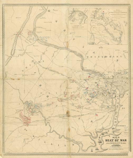
Map of the Seat of War Showing the Battles of July 18th, 21st & Oct. 21st

| This map shows Manassas during the First Battle of Bull Run, in which the 2nd Wisconsin Infantry fought, and the Leesburg area, the site of the Battle of Ball's Bluff. Roads and railroads, cities and towns, vegetation, drainage, and battery positions are shown. Two insets are included: Leesburg to Harper's Ferry and Map from the mouth of Occoquan River to Richmond showing rebel batteries of the Potomac River. Encampments are colored and an inset map shows Leesburg to Harpers Ferry. |
| Image ID: | 89178 |
|---|---|
| Creation Date: | 1861 |
| Creator Name: | McKean, E. R. |
| City: | Manassas |
| County: | |
| State: | Virginia |
| Collection Name: | Map Collection |
| Genre: | Map or Atlas |
| Original Format Type: | prints, photomechanical |
| Original Format Number: | GX8638 F16 1861 M1 |
| Original Dimensions: | unknown |
| Drawn by E.R. McKean; put. by V.P. Corbett; lith. By A. Hoen & Co. |
| Land |
| Battlefields |
| Battles |
| Civil War, 1861-1865 |
| Military camps |
| War work |
| This image is issued by the Wisconsin Historical Society. Use of the image requires written permission from the staff of the Collections Division. It may not be sold or redistributed, copied or distributed as a photograph, electronic file, or any other media. The image should not be significantly altered through conventional or electronic means. Images altered beyond standard cropping and resizing require further negotiation with a staff member. The user is responsible for all issues of copyright. Please Credit: Wisconsin Historical Society. |
| Location: | Wisconsin Historical Society Archives, 4th Floor, Madison, Wisconsin |
|---|
