Map or Atlas
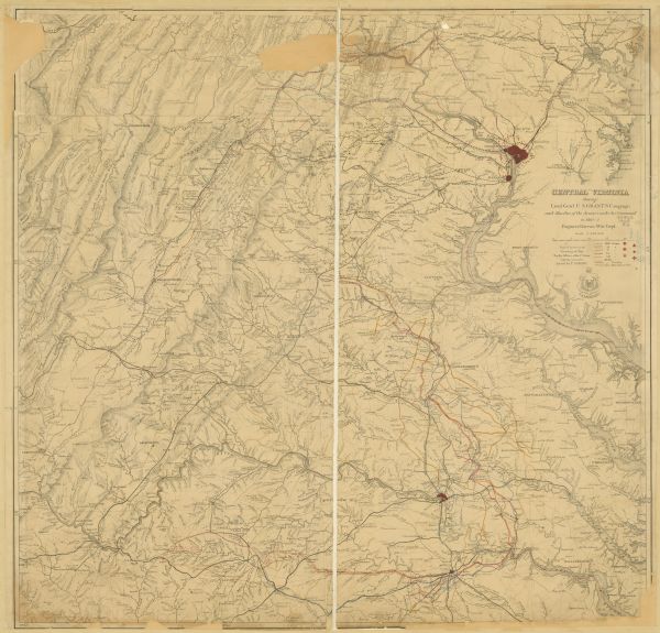
Central Virginia Showing Lieut. Gen'l U.S. Grant's Campaign and Marches of the Armies Under His Command in 1864-5

| Map extends from Harper's Ferry in the north to Petersburg in the south and from Lexington east to Heathsville. The routes of the II, V, VI, IX, XVIII, and XIX corps, the regular cavalry, and Sheridan's cavalry are identified by colored lines. The badges of the corps are given in the legend. The map also indicates roads, railroads, towns, drainage, and relief by hachures. |
| Image ID: | 90860 |
|---|---|
| Creation Date: | 1865 |
| Creator Name: | United States. Engineer Department. |
| City: | Petersburg |
| County: | |
| State: | Virginia |
| Collection Name: | Map Collection |
| Genre: | Map or Atlas |
| Original Format Type: | prints, photomechanical |
| Original Format Number: | GX863 1864 EG |
| Original Dimensions: | 31.25 x 30.5 inches |
| Battlefields |
| Battles |
| Civil War, 1861-1865 |
| Railroads |
| Roads |
| Land |
| This image is issued by the Wisconsin Historical Society. Use of the image requires written permission from the staff of the Collections Division. It may not be sold or redistributed, copied or distributed as a photograph, electronic file, or any other media. The image should not be significantly altered through conventional or electronic means. Images altered beyond standard cropping and resizing require further negotiation with a staff member. The user is responsible for all issues of copyright. Please Credit: Wisconsin Historical Society. |
| Location: | Wisconsin Historical Society Archives, 4th Floor, Madison, Wisconsin |
|---|
