Located between State Highway 181 at Interstate 94 and North 72nd Street | National or State Registers Record | Wisconsin Historical Society

National or State Registers Record

Located between State Highway 181 at Interstate 94 and North 72nd Street

National or State Register of Historic Places
Located between State Highway 181 at Interstate 94 and North 72nd Street | National or State Registers Record | Wisconsin Historical Society
NAMES
Historic Name:Honey Creek Parkway
Reference Number:10000458
PROPERTY LOCATION
Location (Address):Located between State Highway 181 at Interstate 94 and North 72nd Street
County:Milwaukee
City/Village:Wauwatosa
Township:
SUMMARY
Honey Creek Parkway
Located between State Trunk Highway 181 at Interstate 94 (I-94) and North 72nd Street, Wauwatosa, Milwaukee County
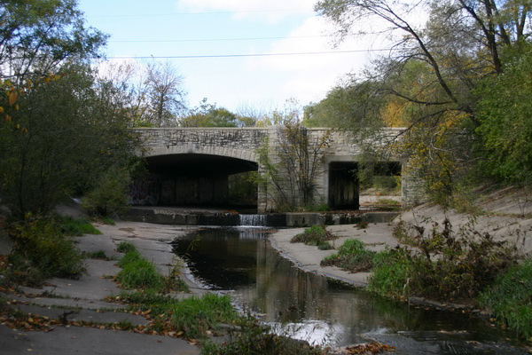
Dates of construction of contributing features: 1928-1941
Designer: Alfred Boerner

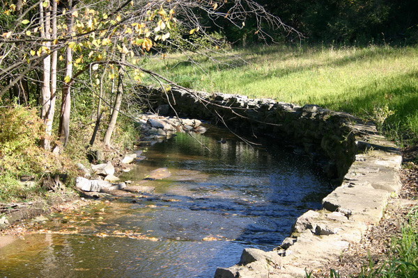
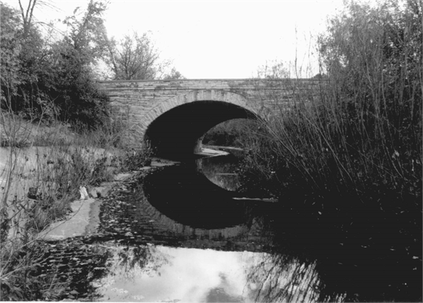
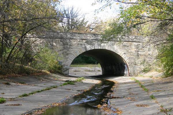
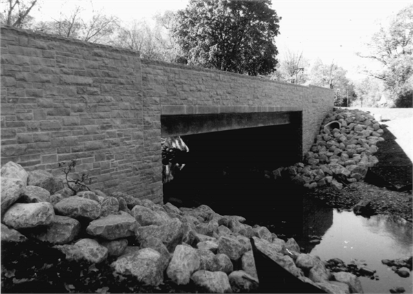
The Honey Creek Parkway is centrally located in Milwaukee County. As part of the Milwaukee County parkway system, it discontinuously follows Honey Creek from its confluence with the Menomonee River in Wauwatosa south through State Fair Park and to Oklahoma Avenue in West Allis. Charles B. Whitnall included Honey Creek Parkway in his 1923 study of a county-wide parkway system, promoting the health and aesthetic benefits of urban parklands. Alfred Boerner, a Milwaukee County landscape architect and Wisconsin native, was instrumental in drawing up the plans. However, work on the Parkway was not implemented until 1932 when federal work relief efforts made development possible. Civilian Conservation Corps (CCC) and Works Progress Administration (WPA) labor was responsible for creek relocation and widening, road grading, bridge and road construction, and landscaping.

The property has been well maintained, and the Parkway remains historically intact. It is a strong example of parkway design, and serves as a reminder of automobile culture and recreation, as well as community development, from early twentieth century Milwaukee County.

PROPERTY FEATURES
Period of Significance:1932-1955
Area of Significance:Community Planning And Development
Applicable Criteria:Event
Historic Use:Transportation: Road-Related
Architectural Style:Other
Resource Type:District
Architect:Boerner, Alfred
DESIGNATIONS
Historic Status:Listed in the National Register
Historic Status:Listed in the State Register
National Register Listing Date:07/08/2010
State Register Listing Date:07/17/2009
NUMBER OF RESOURCES WITHIN PROPERTY
Number of Contributing Buildings:0
Number of Contributing Sites:1
Number of Contributing Structures:7
Number of Contributing Objects:0
Number of Non-Contributing Sites:1
Number of Non-Contributing Structures:7
Number of Non-Contributing Objects:0
RECORD LOCATION
National Register and State Register of Historic Places, State Historic Preservation Office, Wisconsin Historical Society, Madison, Wisconsin

How to Cite

For the purposes of a bibliography entry or footnote, follow this model:

National Register of Historic Places Citation
National Register of Historic Places, "Historic Name", "Town", "County", "State", "Reference Number".

Have Questions?

If you didn't find the National Register listing you were looking for or have other questions about the National Register, please email us and we can help: