Upper Twin Falls Road over the Menominee River

| Historic Name: | Upper Twin Falls Bridge |
|---|---|
| Reference Number: | 12001028 |
| Location (Address): | Upper Twin Falls Road over the Menominee River |
|---|---|
| County: | Florence |
| City/Village: | |
| Township: | Florence |
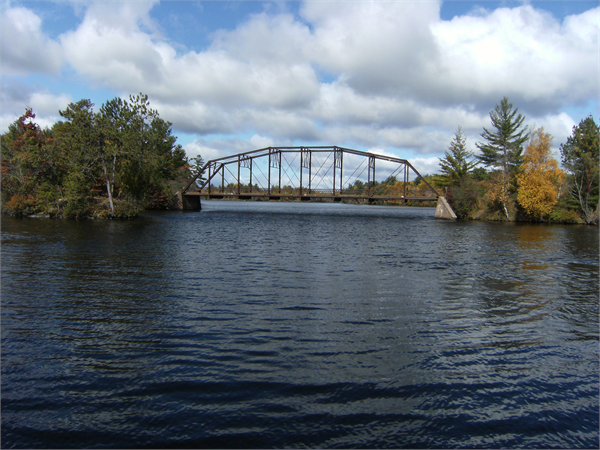
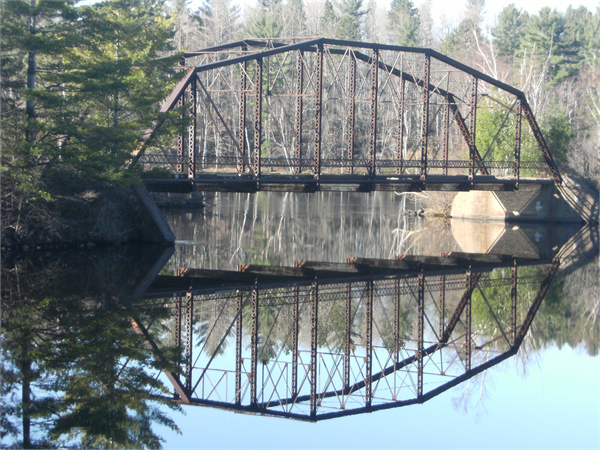
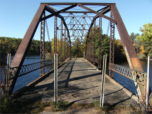
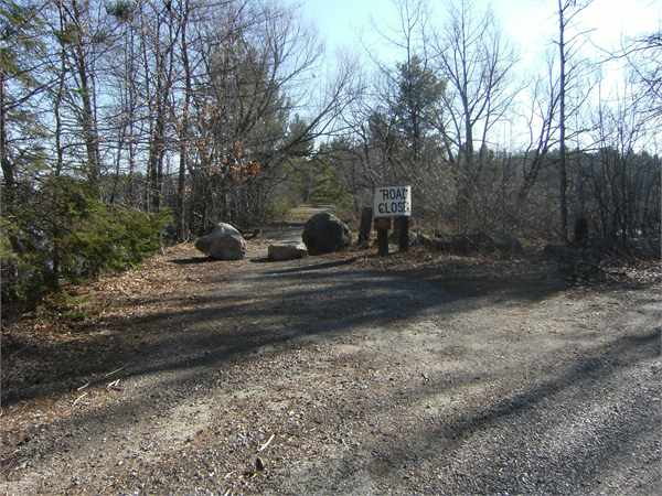
| Upper Twin Falls Bridge Upper Twin Falls Road over Menominee River, Town of Florence, Florence County, Wisconsin and Breitung Township, Dickinson County, Michigan Dates of construction: 1910-1911 Designer: Martin W. Torkelson The Upper Twin Falls Bridge is a camelback steel through truss structure built in 1910 to 1911 that spans the channel of the Menominee River on the Michigan-Wisconsin border. Engineer Martin W. Torkelson of the Wisconsin Geological and Natural History Survey's Highway Division designed the 145 foot long bridge and it was built by the Central States Bridge Company of Indiana. The bridge is connected to the mainland via two long causeways. Though not a massive project by today's standards, the construction of the quarter-mile long causeway system, which required earth fill embankments about twenty-five feet across at the top and up to about twenty-five feet in height to span the broadened river that would back up behind the dam, was an impressive civil engineering work for the period. The bridge is an example of a camelback truss, a late nineteenth-century variation of the Parker truss, distinguished by its specifically five-slope top chord. The five-slope design allowed for greater standardization and better stress distribution, while being more economical to construct. In the late nineteenth and early twentieth centuries the camelback truss was most commonly used for highway bridge spans of 100 to 200 feet. The Upper Twin Falls Bridge was closed to traffic in September 1971. The bridge and causeway system were initially open to pedestrian use, but access is now restricted because of the severe deterioration of the concrete bridge deck. |
| Period of Significance: | 1910-1911 |
|---|---|
| Area of Significance: | Engineering |
| Applicable Criteria: | Architecture/Engineering |
| Historic Use: | Transportation: Road-Related |
| Historic Use: | Recreation And Culture: Monument/Marker |
| Architectural Style: | Other |
| Resource Type: | Structure |
| Architect: | Torkelson, Martin W. |
| Architect: | Central States Bridge Company |
| Historic Status: | Listed in the State Register |
|---|---|
| Historic Status: | Listed in the National Register |
| National Register Listing Date: | 12/12/2012 |
| State Register Listing Date: | 08/24/2012 |
| Number of Contributing Buildings: | 0 |
|---|---|
| Number of Contributing Sites: | 0 |
| Number of Contributing Structures: | 3 |
| Number of Contributing Objects: | 0 |
| Number of Non-Contributing Buildings: | 0 |
| Number of Non-Contributing Sites: | 0 |
| Number of Non-Contributing Structures: | 0 |
| Number of Non-Contributing Objects: | 1 |
| National Register and State Register of Historic Places, State Historic Preservation Office, Wisconsin Historical Society, Madison, Wisconsin |