N 16th ST from W CLYBOURN ST TO W PIERCE ST
| Historic Name: | 16th Street Viaduct |
|---|---|
| Reference Number: | 100003908 |
| Location (Address): | N 16th ST from W CLYBOURN ST TO W PIERCE ST |
|---|---|
| County: | Milwaukee |
| City/Village: | Milwaukee |
| Township: |
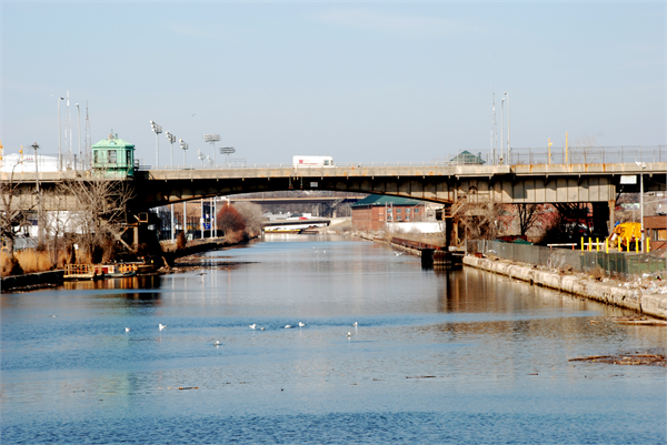
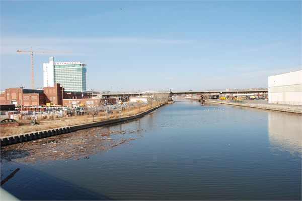
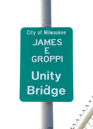
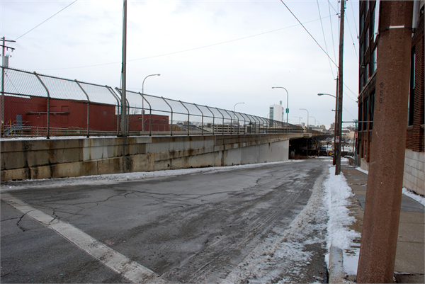
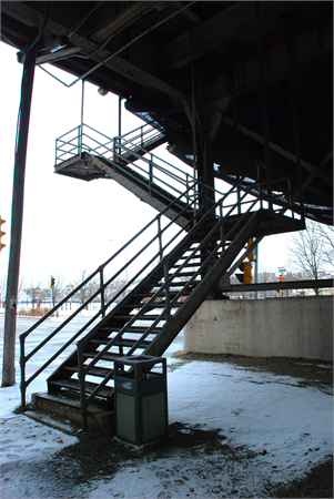
| 16th STREET VIADUCT 16th Street from West Courtney Street to West Pierce Street, Milwaukee, Wisconsin Builder: City of Milwaukee Department of Public Works Date of construction: 1929 This 4,000-foot-long, steel girder, motor and pedestrian viaduct is a testament to the struggle to overcome Milwaukee’s racial divisions. Consisting of 79 spans, it carries traffic over the Menomonee River Valley, a historic dividing line. In the 1960s, the vast majority of Milwaukee’s African American population lived north of the viaduct. To the south were 300,000 white residents, many of Eastern European ancestry. Through the mid-1960s, discriminatory practices by landlords, real estate agents, and financial institutions had kept the south side all-white. On the nights of August 28 and 29, 1967, the Youth Council (YC) of the Milwaukee Chapter of the National Association for the Advancement of Colored People led marches across the bridge. About 200 demonstrators and their advisor, Father James Groppi, were headed to Kosciuszko Park in the heart of the south side to hold a rally for equal access to housing. They were greeted by thousands of suspicious whites, some shouting racial slurs and others bombarding them with rocks and bottles. When the city’s Common Council declined to enact an open housing ordinance, the YC kept up the protests for 200 consecutive days. A number of the later demonstrations crossed over the viaduct. The demonstrations forced city leaders to confront the issue of housing discrimination. On April 30, 1968, the Common Council passed a strong open housing ordinance. Father Groppi and the YC were widely condemned in the 1960s. By 1988, though, attitudes had changed, and the Common Council renamed the viaduct the James A. Groppi Unity Bridge. Periodically updated to accommodate changing traffic demands, the viaduct serves as a reminder that human rights are rarely granted without a struggle. |
| Period of Significance: | 1967-1968 |
|---|---|
| Area of Significance: | Ethnic Heritage/Black |
| Area of Significance: | Social History |
| Applicable Criteria: | Event |
| Historic Use: | Transportation: Road-Related |
| Architectural Style: | Other |
| Resource Type: | Structure |
| Historic Status: | Listed in the State Register |
|---|---|
| Historic Status: | Listed in the National Register |
| National Register Listing Date: | 05/07/2019 |
| State Register Listing Date: | 02/15/2019 |
| Number of Contributing Buildings: | 0 |
|---|---|
| Number of Contributing Sites: | 0 |
| Number of Contributing Structures: | 1 |
| Number of Contributing Objects: | 0 |
| Number of Non-Contributing Buildings: | 0 |
| Number of Non-Contributing Sites: | 0 |
| Number of Non-Contributing Structures: | 0 |
| Number of Non-Contributing Objects: | 0 |
| National Register and State Register of Historic Places, State Historic Preservation Office, Wisconsin Historical Society, Madison, Wisconsin |