 Filter: Categories of Wisconsin Historical Images
Filter: Creator Name of Public Service Commission of Wisconsin. Accounts and Finance Division.
Filter: Categories of Wisconsin Historical Images
Filter: Creator Name of Public Service Commission of Wisconsin. Accounts and Finance Division.
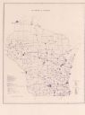
| Date: | 1974 |
|---|---|
| Description: | This blue line map show gas services and county boundaries. Includes a legend of company names in lower left hand corner. |
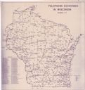
| Date: | 11 1973 |
|---|---|
| Description: | This map shows the cities, county boundaries and telephone exchange locations. The map includes a numbered list of telephone companies. |
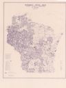
| Date: | 06 1975 |
|---|---|
| Description: | This map shows electrical utilities and cooperatives throughout the state, as well as cities and county boundaries. The bottom left corner of the map inclu... |
If you didn't find the material you searched for, our Library Reference Staff can help.
Call our reference desk at 608-264-6535 or email us at: