 Filter: Categories of Wisconsin Historical Images
Filter: County of Dodge
Filter: Year of 1800-1899
Filter: Year of 1850-1859
Filter: Categories of Wisconsin Historical Images
Filter: County of Dodge
Filter: Year of 1800-1899
Filter: Year of 1850-1859

| Date: | 1852 |
|---|---|
| Description: | Map created between 1852 and 1867 shows numbered lots, labelled roads, the "Centre Line of LaCrosse & Milwaukee R.R." railroad, and a station house. Roads ... |

| Date: | 1856 |
|---|---|
| Description: | This map shows a plat of the town, local streets, lots, and part of the Rock River. The margins of the map have manuscript annotations in ink. |
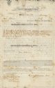
| Date: | 01 29 1853 |
|---|---|
| Description: | Document of agreement between Oren Johnson of Dodge County and the La Crosse and Milwaukee Rail Road Company. Johnson agreed to pay $600 plus 8% annual int... |
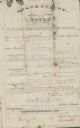
| Date: | 07 09 1853 |
|---|---|
| Description: | Legal title to Oren Johnson's mortgaged land in Dodge County. The La Crosse and Milwaukee Rail Road Company assessed the land for $1,500. |

| Date: | 05 1854 |
|---|---|
| Description: | This yellow and black wood block print broadside ties England and France's declaration of war against Russia during the Crimean War into a war against high... |
If you didn't find the material you searched for, our Library Reference Staff can help.
Call our reference desk at 608-264-6535 or email us at: