 Filter: Categories of Wisconsin Historical Images
Filter: County of Fond du Lac
Filter: Type of Map or Atlas
Filter: Subject of water
Filter: Categories of Wisconsin Historical Images
Filter: County of Fond du Lac
Filter: Type of Map or Atlas
Filter: Subject of water

| Date: | 1867 |
|---|---|
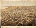
| Description: | Birds eye drawing of Fond du Lac depicts street names and street layouts, houses, buildings, trees, and the Fond du Lac River. A reference key at the botto... |

| Date: | 1867 |
|---|---|
| Description: | Bird's-eye map of Ripon, with insets of points of interest. |

| Date: | 1885 |
|---|---|
| Description: | Bird's-eye map of Waupun on the Rock River. There is an inset at top center of "Althouse, Wheeler & Co., Windmills and Pumps." |

| Date: | 1857 |
|---|---|
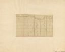
| Description: | Quarter section of a map of the city of Fond du Lac featuring an illustration of the Lewis House. |
| Date: | |
|---|---|
| Description: | Map shows rivers and acreages in part of Fond du Lac township and Fond du Lac, Wisconsin. |

| Date: | 1840 |
|---|---|
| Description: | Shows plat of town, local streets, Fond du Lac River, and part of Lake Winnebago. |
| Date: | 1867 |
|---|---|
| Description: | Bird’s-eye view map. Indexed for points of interest. |

| Date: | 1874 |
|---|---|
| Description: | Includes index to key buildings. Shows local streets, railroads, fairgrounds, mills, schools, churches, and part of Lake Winnebago. Streets running west to... |

| Date: | 1916 |
|---|---|
| Description: | Includes index to businesses, churches, and schools. Shows local streets, buildings, railroads, ward divisions, Fond du Lac River, and part of Lake Winneba... |

| Date: | 1956 |
|---|---|
| Description: | Includes street index. Shows local streets, parks, highways, railroads, Fond du Lac River, and part of lake Winnebago. Also includes text on points of inte... |

| Date: | 1956 |
|---|---|
| Description: | Includes street index and index to points of interest. Shows land ownership by name, plat of town, local streets, schools, parks, highways, railroads, ward... |

| Date: | 1800 |
|---|---|
| Description: | Shows plat of town, land ownership by name, local streets, courthouses, churches, hotels, mills, railroads, railroad stations, lakes, and rivers. Includes ... |

| Date: | 1800 |
|---|---|
| Description: | Ink and watercolor on tracing paper. Shows plat of town, local streets, Fond du Lac River, and part of Lake Winnebago. |

| Date: | 1930 |
|---|---|
| Description: | Map of Ripon, Wisconsin. In the lower left hand corner is a list of points of interest that correspond with numbers on the map. Streets and Mill Pond are l... |

| Date: | 1857 |
|---|---|
| Description: | This map has relief shown by hachures and pictorially and shows plat of the town, wards, lots, land ownership by name, local roads, highways, railroads, pa... |
| Date: | 1911 |
|---|---|
| Description: | This map shows soil types, lakes, rivers, and railroads. A key of soil profiles and a legend of soil types is included. The bottom margin reads: "Soils su... |

| Date: | 03 25 1931 |
|---|---|
| Description: | This blueline print map shows lot and block numbers, additions, churches, and public land in North and South wards as they were in 1884. Towards the top of... |

| Date: | 1836 |
|---|---|
| Description: | This map shows land parcels, streets, the Fond du Lac River, Lake Winnebaygo (Winnebago), and blocks. Certification is on the left hand corner. The back of... |

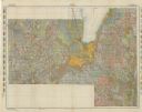
| Date: | 1904 |
|---|---|
| Description: | Map showing lots, additions, and wards within the city limits, as well as some landownership. The streets are labeled, as is Lake Winnebago, rivers, railro... |
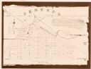
| Date: | 1994 |
|---|---|
| Description: | This cadastral map shows Mill Pond, buildings, some landowners, cemetery, and out-lots. The upper right corner includes a statement about Ceresco. |
If you didn't find the material you searched for, our Library Reference Staff can help.
Call our reference desk at 608-264-6535 or email us at: