 Filter: Categories of Wisconsin Historical Images
Filter: County of Iowa
Filter: Type of Map or Atlas
Filter: Creator Name of Unknown
Filter: Categories of Wisconsin Historical Images
Filter: County of Iowa
Filter: Type of Map or Atlas
Filter: Creator Name of Unknown

| Date: | 1840 |
|---|---|
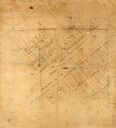
| Description: | A hand-drawn plat map of Mineral Point, Wisconsin showing street layout and location of buildings. |

| Date: | |
|---|---|
| Description: | A hand-colored geological cross section of Iowa County and eastern Dane County, Wisconsin, from the Blue Mounds north-northwest to the sandy plain of the W... |

| Date: | 1836 |
|---|---|
| Description: | This early to mid-19th century map shows the township and range system, sections, landownership, furnaces, lead mines, copper mines, and roads in the vicin... |

| Date: | 1832 |
|---|---|
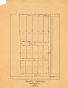
| Description: | This map shows lot and block numbers, as well as the location of a shot tower, houses, stores, and barns. The map is oriented with the north to the left. T... |
| Date: | 1930 |
|---|---|
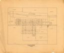
| Description: | This map is pen and pencil on paper and shows local streets, lots by number, and section divisions. |
| Date: | 1967 |
|---|---|
| Description: | This map is pen and pencil on paper and shows land ownership by name, blocks, lots, local streets, and railroads. To the right of the title the map reads: ... |

| Date: | 1840 |
|---|---|
| Description: | This map shows local streets, numbered lots, and part of Blue Mounds Branch. The map reads: "NE 1/4 NW 1/4 Sect. 16 - T5 - R5E." under the title and is dat... |
| Date: | 1800 |
|---|---|
| Description: | This map is pencil and ink on tracing cloth. The map shows plat of the town and local streets. There are some manuscript annotations in pencil and red ink. |
If you didn't find the material you searched for, our Library Reference Staff can help.
Call our reference desk at 608-264-6535 or email us at:

