 Filter: Categories of Wisconsin Historical Images
Filter: County of Iowa
Filter: Type of Map or Atlas
Filter: Subject of water
Filter: Categories of Wisconsin Historical Images
Filter: County of Iowa
Filter: Type of Map or Atlas
Filter: Subject of water

| Date: | 1856 |
|---|---|
| Description: | Wisconsin map illustrating the Mineral Point Railroad and its connections. |

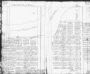
| Date: | 07 02 1836 |
|---|---|
| Description: | An ink on paper, hand-drawn map shows the sections and streams in Township 5, Range 1 east, which covers parts of the present-day towns of Mifflin and Lind... |

| Date: | |
|---|---|
| Description: | A hand-colored geological cross section of Iowa County and eastern Dane County, Wisconsin, from the Blue Mounds north-northwest to the sandy plain of the W... |

| Date: | 1901 |
|---|---|
| Description: | A hand-colored map of Iowa County, Wisconsin, shows townships and sections, towns, cities and villages, streams, landownership, roads, railroads and rural ... |

| Date: | 1847 |
|---|---|
| Description: | Shows parts of northeastern Iowa County, northwestern Dane County, and the extreme southern part of Sauk County "shewing the position of the British Temper... |

| Date: | 1832 |
|---|---|
| Description: | This map shows lot and block numbers, as well as the location of a shot tower, houses, stores, and barns. The map is oriented with the north to the left. T... |
| Date: | 1900 |
|---|---|
| Description: | This Plat map shows the second location of Helena's (of three) on the banks of the Wisconsin River. It also shows the location of shot tower northeast of t... |
If you didn't find the material you searched for, our Library Reference Staff can help.
Call our reference desk at 608-264-6535 or email us at:

