 Filter: Categories of Wisconsin Historical Images
Filter: FORMAT_DIMENSIONS of 56 x 44 cm.
Filter: Subject of rivers
Filter: Categories of Wisconsin Historical Images
Filter: FORMAT_DIMENSIONS of 56 x 44 cm.
Filter: Subject of rivers

| Date: | 1857 |
|---|---|
| Description: | A map of the state of Wisconsin and the southeastern portion of the Territory of Minnesota, showing the Wisconsin reservations of the Oneida, Menominee, St... |

| Date: | |
|---|---|
| Description: | A map of Grant County, Wisconsin showing the locations of townships, towns, cities, villages, roads, railroads, schools, cemeteries, churches, rivers, and ... |

| Date: | 1954 |
|---|---|
| Description: | This map of Waukesha shows numbered ward boundaries, roads, and some buildings. The bottom of the map includes a street index. |

| Date: | 1962 |
|---|---|
| Description: | This map shows the voting districts of Waukesha in red ink for the year 1962. The bottom of the map includes an index of streets. |

| Date: | 1947 |
|---|---|
| Description: | This map of Wauwatosa shows 10 zoning class types of land including residential, manufacturing, and business. The map also shows government buildings, some... |

| Date: | 1935 |
|---|---|
| Description: | This map includes an index on the right margin of industrial plants, churches, schools, and public buildings. Streets, the Rock River, Lake Michigan, parks... |
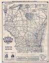
| Date: | 1929 |
|---|---|
| Description: | This map shows county boundaries, roads, highways, cities, rivers, lakes, and points of interest. Caption reads: "Compliments of Hotel Warren, Baraboo, Wis... |
If you didn't find the material you searched for, our Library Reference Staff can help.
Call our reference desk at 608-264-6535 or email us at: