 Filter: Categories of Wisconsin Historical Images
Filter: FORMAT_NUMBER_ORG of GX9029 W81 M
Filter: Subject of railroads
Filter: Categories of Wisconsin Historical Images
Filter: FORMAT_NUMBER_ORG of GX9029 W81 M
Filter: Subject of railroads
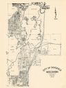
| Date: | 1965 |
|---|---|
| Description: | This map shows lot and block numbers and dimensions, additions, streets, and railroads. |

| Date: | 1965 |
|---|---|
| Description: | This map shows lot and block numbers and dimensions, railroads, and streets and is dated: "March 1965." The map includes manuscript annotations that show m... |

| Date: | 1960 |
|---|---|
| Description: | This map is a cadastral map and shows block and lot numbers and dimensions, additions, streets, railroad, and Kiel Municipal Cemetery. The bottom right mar... |

| Date: | 1960 |
|---|---|
| Description: | This map shows lot numbers and dimensions, railroad, and streets. Fall Creek and Mill Pond (now Fall Creek Pond) are labeled. The map is a blue line print. |
If you didn't find the material you searched for, our Library Reference Staff can help.
Call our reference desk at 608-264-6535 or email us at: