Filter: Categories of Wisconsin Historical Images
Filter: FORMAT_TYPE of photographic print, b
Filter: Subject of botany
Filter: Subject of wisconsin river (wis.)
Filter: Categories of Wisconsin Historical Images
Filter: FORMAT_TYPE of photographic print, b
Filter: Subject of botany
Filter: Subject of wisconsin river (wis.)
| Date: | |
|---|---|
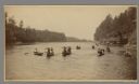
| Description: | Excursion boats at the Wisconsin Dells. Boats Eolah and Alexander Mitchell at mooring, with distinctive Dells rock formations in the backgrou... |
| Date: | |
|---|---|
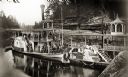
| Description: | The Alexander Mitchell excursion boat with passengers. |
| Date: | |
|---|---|
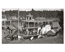
| Description: | Mouth of Witches' Gulch and downstream, viewed from cliff. Steamboat Alexander Mitchell at mouth of gulch. Four canoes are on shore. |

| Date: | 1885 |
|---|---|
| Description: | Elevated view of the "Dell Queen" entering the Narrows via Devil's Elbow as Hattie and Nellie Bennett look on from an overlook on the shoreline. |
| Date: | |
|---|---|
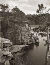
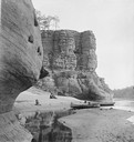
| Description: | North face of High Rock. Two women are sitting on the sandy beach, one child is playing along the shoreline near a rowboat and canoe pulled up on the sandy... |
| Date: | |
|---|---|
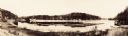
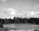
| Description: | Panoramic view of the Upper Dells River as seen from the Dell House. |
| Date: | |
|---|---|
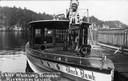
| Description: | Chief Whirling Thunder, standing at the front of an excursion boat named "Black Hawk," which appears to be near the Wisconsin Dells. Caption reads: "Chief ... |
| Date: | 1911 |
|---|---|
| Description: | Winter scene, probably along the Wisconsin River, possibly near Taliesin, the home of Frank Lloyd Wright. Taliesin is located in the vicinity of Spring Gre... |

| Date: | 1920 |
|---|---|
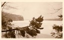
| Description: | Bridge over river from shoreline seen through trees in the spring or summer. Part of the bridge is covered. |
| Date: | 1920 |
|---|---|
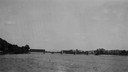
| Description: | View across water towards the partially covered bridge. A wooded shoreline is along the left and right. |

| Date: | 1920 |
|---|---|
| Description: | Aerial view of the last covered bridge, which is no longer standing. |
| Date: | 1900 |
|---|---|
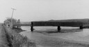
| Description: | View from road of a partially covered bridge. Industrial buildings are near the entrance to the bridge on the left. |

| Date: | 1945 |
|---|---|
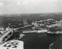
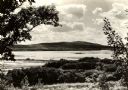
| Description: | Wyalusing State Park in the Prairie du Chein vicinity. The Wisconsin River is in the foreground and the Mississippi river can be seen below with distant bl... |
| Date: | 1955 |
|---|---|
| Description: | Aerial view of Wisconsin Dells. The wing of the airplane is in the left foreground. |
| Date: | 1945 |
|---|---|
| Description: | View of the Wausau Memorial Hospital, with the Wisconsin River in the foreground. |
| Date: | 07 1912 |
|---|---|
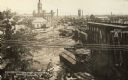
| Description: | Elevated view across the Wisconsin River, showing the wreckage left by the disastrous flood of July 24, 1912. A power dam on the Wisconsin River above Waus... |
| Date: | 1930 |
|---|---|
| Description: | View looking west at Rib Mountain across the Wisconsin River from the outskirts of Wausau. |

| Date: | 1900 |
|---|---|
| Description: | View from bank of river towards the Cereal Mills Company, looking North toward Big Bull Falls. |
If you didn't find the material you searched for, our Library Reference Staff can help.
Call our reference desk at 608-264-6535 or email us at: