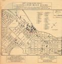
| Date: | 1914 |
|---|---|
| Description: | Includes index of University of Wisconsin buildings, churches, and public buildings. Top of Map reads: '"GET A SQUARE DEAL" AT THE COLLEGE BOOK STORE SHOWN... |

| Date: | 1890 |
|---|---|
| Description: | This map of Superior shows city wards, bays, docks, some businesses and points of interest. Relief is shown by hachures. The back of the map features a typ... |

| Date: | 1898 |
|---|---|
| Description: | This map of Superior shows city wards, bays, docks, and some businesses and points of interest. Relief is shown by hachures. The map probably came from a C... |

| Date: | 1934 |
|---|---|
| Description: | This map provides automobile routes through Wisconsin along with portions of Illinois, Iowa, Minnesota and Michigan. Lake Superior, Lake Michigan, Green B... |

| Date: | 1939 |
|---|---|
| Description: | Advertising proof. Features an illustration of a man driving a truck in the Court of Pacifica. Below is Treasure Island and the hills of Berkeley. |

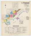
| Date: | 09 1918 |
|---|---|
| Description: | An insurance map of Washburn, with an index and a key. Includes a small inset map of the State of Wisconsin that shows "Location of this town as above unde... |
If you didn't find the material you searched for, our Library Reference Staff can help.
Call our reference desk at 608-264-6535 or email us at: