| Date: | |
|---|---|
| Description: | Memohead of Seymour's Bank in Chippewa Falls, Wisconsin, with a three-quarter view of the bank building, including people coming and going on the sidewalk ... |

| Date: | |
|---|---|
| Description: | Letterhead of the William Rahr Sons' Company of Manitowoc, Wisconsin, "Maltsters and Roasters," with an elevated view of the company building on one side o... |

| Date: | 1906 |
|---|---|
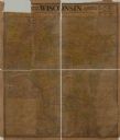
| Description: | A hand-colored commercial map of Wisconsin and portions of eastern Minnesota, Iowa, northern Illinois, and the Michigan’s Upper Peninsula. The map shows ra... |

| Date: | 1870 |
|---|---|
| Description: | Front cover of catalog with a green cover for Wood's harvesting machines. Features an illustration of, at the top, a view of a town, flanked by two women, ... |

| Date: | 1923 |
|---|---|
| Description: | This map includes an explanation that reads: "This chart shows the movement of wheat on the Great Lakes, St. Lawrence River, and New York State Barge Canal... |
If you didn't find the material you searched for, our Library Reference Staff can help.
Call our reference desk at 608-264-6535 or email us at: