Filter: Categories of Wisconsin Historical Images
Filter: FORMAT_TYPE of prints, photomechanical
Filter: Subject of piers
Filter: Categories of Wisconsin Historical Images
Filter: FORMAT_TYPE of prints, photomechanical
Filter: Subject of piers

| Date: | 1886 |
|---|---|
| Description: | Bird's-eye view of Ashland, on the shores of Lake Superior, with insets of The Apostle Islands Chequamagon Bay & Ashland, and Distances from Ashland. |

| Date: | 1929 |
|---|---|
| Description: | Advertising poster for International trucks showing a coloring illustration of a truck at a dock site with a large ship in the background. Imprinted with "... |

| Date: | 1929 |
|---|---|
| Description: | Advertising poster for International trucks. Features a color illustration of a truck at a wharf or dock with a large ship in the background. |

| Date: | 1856 |
|---|---|
| Description: | View looking west from Lake Michigan with several steam ships and sailing vessels in harbor. There is a lighthouse to left of center, along shoreline. |

| Date: | 1890 |
|---|---|
| Description: | Bird's-eye map of Ashland, viewed from Lake Superior, with insets of Prentice Park and Fishery. Population 16,000. Increase in Ten Years, 11,000. |
| Date: | 1910 |
|---|---|
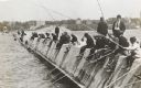
| Description: | Long row of men in suits and hats fishing on the breakwater. |
| Date: | 1893 |
|---|---|
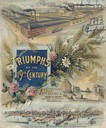
| Description: | Cover of an advertising catalog for William Deering & Company featuring chromolithograph illustrations of the Deering factory, the grain center of the worl... |

| Date: | 1885 |
|---|---|
| Description: | Bird's-eye view of Sheboygan, with inset of J.J. Volrath Manufacturing Company. |

| Date: | 1883 |
|---|---|
| Description: | Bird's-eye map of Superior, county seat of Douglas County, on the shores of Lake Superior, with insets of points of interest. |

| Date: | 1913 |
|---|---|
| Description: | Bird's-eye map of Superior. "The New Steel Center." |

| Date: | 1915 |
|---|---|
| Description: | Bird's-eye view of Superior, Wisconsin, and Duluth, Minnesota on opposite shore of Lake Superior. |

| Date: | 1886 |
|---|---|
| Description: | Bird's-eye map of Washburn on Lake Superior. There is an inset of Washburn, Chequamagon and the Apostle Islands. |

| Date: | 1879 |
|---|---|
| Description: | Bird's-eye map of Two Rivers. |

| Date: | 1896 |
|---|---|
| Description: | Bird's-eye view of Washburn, with twenty vignettes around side, water in foreground with docks and lumber corral. Thirty-three locations identified in key ... |

| Date: | 1892 |
|---|---|
| Description: | Bird's-eye view of Chicago, with ships in the Lake Michigan harbor. |

| Date: | 1892 |
|---|---|
| Description: | Bird's-eye view of the Columbian Exposition pavilions from the vantage point of Lake Michigan. Included is an inset of the Union Passenger Station (now Uni... |

| Date: | 1905 |
|---|---|
| Description: | Camp Stella looking south toward the Bayfield County shoreline from an Apostle Island. |

| Date: | 1920 |
|---|---|
| Description: | Caption reads: "Mammoth Ore Docks, Ashland, Wis." A building and roads are in the foreground. Several ore ships can be seen. |
| Date: | 1910 |
|---|---|
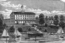
| Description: | View across water towards cabins on the shore of Delavan Lake, with three women standing near the base of a pier. Caption reads: "Log Cabin, Delavan Lake, ... |
If you didn't find the material you searched for, our Library Reference Staff can help.
Call our reference desk at 608-264-6535 or email us at: