| Date: | 1890 |
|---|---|
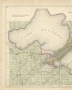
| Description: | Portion of a plat map of Madison featuring Lake Mendota. |

| Date: | 1890 |
|---|---|
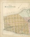
| Description: | Left half of a plat map of the "East Part of the city of Madison". |

| Date: | 1890 |
|---|---|
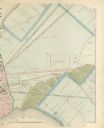
| Description: | Right side of a plat map of the "East Part of the City of Madison". |

| Date: | 1890 |
|---|---|
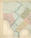
| Description: | Portion of a plat map of the "West Part of the City of Madison". |

| Date: | 1890 |
|---|---|
| Description: | This map oriented with north towards the upper right shows sewers, cases of diphtheria and scarlet fever, schools, and public buildings. Lake Wingra is lab... |

| Date: | 1890 |
|---|---|
| Description: | Plat map of Madison, T7N R9E, including portions of the towns of Blooming Grove and Burke. Includes inset maps of South Madison, Quarrytown, Marril Park, a... |
If you didn't find the material you searched for, our Library Reference Staff can help.
Call our reference desk at 608-264-6535 or email us at: