| Date: | 1914 |
|---|---|
| Description: | This map is a photostat copy from the original 1829 map in the War Department. The map shows location of Fort Howard, lots, land claims of Jacques Porlier ... |

| Date: | 1914 |
|---|---|
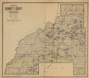
| Description: | This 1914 map of Price County, Wisconsin, shows land for sale by the Good Land Company and Dewitt van Ostrand of Phillips. Also shown are the township and ... |

| Date: | 1914 |
|---|---|
| Description: | Map shows school houses, creameries, post offices, saw mills, grist mills, churches, cemeteries, town halls, stores, roads, state roads, and railroads. "Co... |

| Date: | 1914 |
|---|---|
| Description: | Map shows townships, schools, saw mills, roads, railroads, and post offices. Text on the top left has a box of towns with land in Marathon County. Top righ... |

| Date: | 1914 |
|---|---|
| Description: | Drawing of a sawmill inside three-sided roofed shed, open to the front. Attached to a barn along the back wall. |
If you didn't find the material you searched for, our Library Reference Staff can help.
Call our reference desk at 608-264-6535 or email us at: