Filter: Categories of Wisconsin Historical Images
Filter: FULL_DATE of 1930
Filter: Type of Photograph
Filter: Categories of Wisconsin Historical Images
Filter: FULL_DATE of 1930
Filter: Type of Photograph
| Date: | 1930 |
|---|---|
| Description: | View from street towards a walking path through the woods, with people strolling on the pathway. |
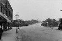
| Date: | 1930 |
|---|---|
| Description: | View of downtown, with a bridge and buildings in the background and storefronts in the foreground. |
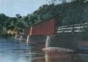
| Date: | 1930 |
|---|---|
| Description: | View of covered bridge, built in 1890, over the Wisconsin River with surrounding landscape. |
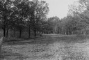
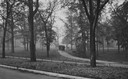
| Date: | 1930 |
|---|---|
| Description: | View of a wide path through trees in the spring or summer. |

| Date: | 1930 |
|---|---|
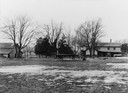
| Description: | Remains of the racetrack on the top of Blue Mound. |
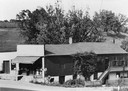
| Date: | 1930 |
|---|---|
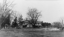
| Description: | Ivey and Webb general store, with trees and a hill behind, and in front a man standing under the store's awning. |
| Date: | 1930 |
|---|---|
| Description: | Street leading down to British Hollow's commercial district. A hill is in the background. |
| Date: | 1930 |
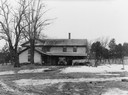
|---|---|
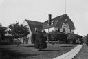
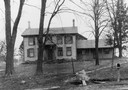
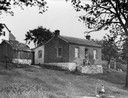
| Description: | Webb house with family standing on back porch. House built by John Webb, an early immigrant and Cornish miner. |

| Date: | 1930 |
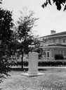
|---|---|
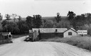
| Description: | View of bridge and Brule River monument. Placed where the Brule River is crossed by the Memorial Highway from Superior to Brule and Ashland (Highway 2). |
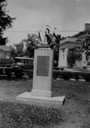
| Date: | 1930 |
|---|---|
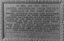
| Description: | Inscription of Brule River monument. Placed where the Brule River is crossed by the Memorial Highway from Superior to Brule and Ashland (Highway 2). |
| Date: | 1930 |
|---|---|
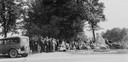
| Description: | View of crowd of people under the trees near the trading post marker in Butte des Morts. |
| Date: | 1930 |
|---|---|
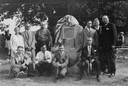
| Description: | Group of people posing near the Grignon-Porlier trading post marker in Butte des Morts. |
| Date: | 1930 |
|---|---|
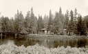
| Description: | Cedar Island on Brule River, a nationally known speckle trout stream. The island has native towering white pine and bubbling clear springs. These are some ... |
If you didn't find the material you searched for, our Library Reference Staff can help.
Call our reference desk at 608-264-6535 or email us at: