| Date: | 1934 |
|---|---|
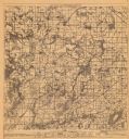
| Description: | This map of Waukesha County, Wisconsin, from the Wisconsin Land Inventory shows the township and range grid, sections, cities and villages, vegetation type... |

| Date: | 1934 |
|---|---|
| Description: | This map shows the area as it appeared in 1848 and includes buildings, land use, and roads with distances to nearby locations. The upper right corner reads... |

| Date: | 1934 |
|---|---|
| Description: | Two unidentified women riding horses with English saddles in the shallow water near the shore of Pine Lake. The women are wearing light-colored jodhpurs an... |

| Date: | 1934 |
|---|---|
| Description: | A morning view of the lake-facing east facade of the Herbert P. Brumder summer home. The story and one half shingle style house has a center gable wing wit... |
If you didn't find the material you searched for, our Library Reference Staff can help.
Call our reference desk at 608-264-6535 or email us at: