 Filter: Categories of Wisconsin Historical Images
Filter: FULL_DATE of 1936
Filter: Subject of wisconsin river (wis.)
Filter: Categories of Wisconsin Historical Images
Filter: FULL_DATE of 1936
Filter: Subject of wisconsin river (wis.)

| Date: | 1936 |
|---|---|
| Description: | This map is red and black ink on tracing cloth and is oriented with north to the upper left. This hand-drawn map shows a central portion of the military ro... |

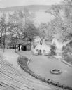
| Date: | 1936 |
|---|---|
| Description: | A view of the Dells of the Wisconsin River, with two people walking down a long dock/walkway leading to a boat. |
| Date: | 1936 |
|---|---|
| Description: | An elevated view towards a Native American man wearing a feathered headdress and a young girl of European descent standing in front of a tepee on the stage... |

| Date: | 1936 |
|---|---|
| Description: | Text reads: "Indians of Wisconsin Dells. The Sentinel." The mailing side of a souvenir view folder containing eight accordion folded, double-sided color im... |
If you didn't find the material you searched for, our Library Reference Staff can help.
Call our reference desk at 608-264-6535 or email us at: