Filter: Categories of Wisconsin Historical Images
Filter: FULL_DATE of 1956
Filter: Subject of cities and towns
Filter: Categories of Wisconsin Historical Images
Filter: FULL_DATE of 1956
Filter: Subject of cities and towns

| Date: | 1956 |
|---|---|
| Description: | Aerial view of Schenk's Corners where Atwood Avenue and Winnebago Street cross, looking north east. |

| Date: | 1956 |
|---|---|
| Description: | Friends Connie Moore (left) and LuRay (Frenchie) Arms pose comically with a motorcycle at 1851 South Park Street. Two children can be seen behind them sitt... |

| Date: | 1956 |
|---|---|
| Description: | Lewis Arms sits on the trunk of a 1949 convertible (DeSoto?) automobile, strumming a guitar. |

| Date: | 1956 |
|---|---|
| Description: | International RD-190 (?) truck with an armored body, operated by the Brinks Express Company on Lake Shore Drive. |

| Date: | 1956 |
|---|---|
| Description: | International RD-190 (?) truck with an armored body, operated by the Brinks Express Company on Lake Shore Drive. Automobiles are in the background. In the ... |

| Date: | 1956 |
|---|---|
| Description: | International RD-190 (?) truck with an armored body, operated by the Brinks Express Company on Lake Shore Drive. Parked cars and a pedestrian are in the ba... |

| Date: | 1956 |
|---|---|
| Description: | A map depicting the for systems of land description in Wisconsin, which include metes and bounds, U.S. System of Rectangular Surveys, Latitude and longitud... |
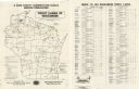
| Date: | 1956 |
|---|---|
| Description: | A map that identifies the trout lakes in Wisconsin and their proximity to cities. Text on the page of the map highlights the conservation actions taken by ... |

| Date: | 1956 |
|---|---|
| Description: | This 1956 map shows sections, cities and villages, roads, railroads, and lakes and streams in the Eagle River area. All or part of the towns of Plum Lake, ... |
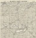
| Date: | 1956 |
|---|---|
| Description: | Map shows townships and sections, landownership and acreages, roads, schools, churches, and cemeteries. |

| Date: | 1956 |
|---|---|
| Description: | Shows roads, railroads, highways, boundaries, and other public facilities and areas. Includes location map and legend. "Corrected for Feb. 1956." "Correcte... |

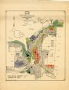
| Date: | 1956 |
|---|---|
| Description: | Map reads: "TAX EXEMPT LAND in the CITY OF MADISON". There is a legend of "Government Land" represented in stripes, "Religious and Fraternal Organization" ... |

| Date: | 1956 |
|---|---|
| Description: | Includes street index. Shows local streets, parks, highways, railroads, Fond du Lac River, and part of lake Winnebago. Also includes text on points of inte... |

| Date: | 1956 |
|---|---|
| Description: | Includes street index and index to points of interest. Shows land ownership by name, plat of town, local streets, schools, parks, highways, railroads, ward... |

| Date: | 1956 |
|---|---|
| Description: | Aerial view of residential homes, farmland and streets. |

| Date: | 1956 |
|---|---|
| Description: | This map of Racine includes a street directory and index of public buildings. Streets, points of interest, Lake Michigan, and the Root River are labeled. A... |
| Date: | 1956 |
|---|---|
| Description: | This map of Rhinelander shows lots, 6 types of zoning in various colors; heavy industry, light industry, commercial, residence "A," residence "unrated," lo... |

| Date: | 1956 |
|---|---|
| Description: | This map is intended for tourists of La Crosse. The front of the map is text about attractions, activities, and accommodations in La Crosse. The back is th... |
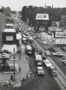
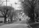
| Date: | 1956 |
|---|---|
| Description: | Elevated view looking on downtown street with traffic, in winter. |
If you didn't find the material you searched for, our Library Reference Staff can help.
Call our reference desk at 608-264-6535 or email us at: