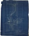
| Date: | 1847 |
|---|---|
| Description: | Shows parts of northeastern Iowa County, northwestern Dane County, and the extreme southern part of Sauk County "shewing the position of the British Temper... |

| Date: | 1899 |
|---|---|
| Description: | These two maps of Madison and the Four Lakes region show the site of the Teachers Country Club on Lake Monona, the lakes and the Catfish or Yahara River, f... |

| Date: | 1889 |
|---|---|
| Description: | Bird’s-eye-view map. Published in the Milwaukee Sentinel: Wednesday morning, August 28, 1889 for the 23rd National Encampments of the GAR, August 27... |

| Date: | 1891 |
|---|---|
| Description: | Map of a proposed subdivision. Map reads: "United States Investment Association SUBDIVISION No. 1 In S.W. 1/4 Sec. 33, Town 8, Range 22 East. Is situated a... |

| Date: | 1891 |
|---|---|
| Description: | This map shows soft marshland, water channels, solid ground, club boundary and shooting boxes. Big Lake, First Channel, Second Channel, Fout Mile Pond, Mal... |

| Date: | 1891 |
|---|---|
| Description: | This map shows soft marshland, water channels, solid ground, club boundary and shooting boxes. Big Lake, First Channel, Second Channel, Fout Mile Pond, Mal... |
If you didn't find the material you searched for, our Library Reference Staff can help.
Call our reference desk at 608-264-6535 or email us at: