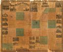
| Date: | 1862 |
|---|---|
| Description: | This map shows townships and sections, landownership and acreages, roads, railroads, cemeteries, churches, schools, mills, and stone quarries. "Engraved, p... |

| Date: | 1904 |
|---|---|
| Description: | Map shows townships and sections, landownership and acreages, roads and railroads, and selected buildings. "1904" inscribed on map in pen. Includes busines... |

| Date: | |
|---|---|
| Description: | Plaque marker identifying the “Pioneer Military Road” route from Fort Howard at Green Bay to Fort Crawford at Prairie du Chien. |

| Date: | |
|---|---|
| Description: | Color illustration of the bath house at the lake front, seen from along a stony shoreline. Caption reads: "New Bath House, Fond du Lac, Wis." |
If you didn't find the material you searched for, our Library Reference Staff can help.
Call our reference desk at 608-264-6535 or email us at: