| Date: | 1917 |
|---|---|
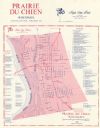
| Description: | This map shows streets, land owners, local businesses, the St. Louis River, and bridges. The maps reads: "Incorporated 1917." The back of the map includes ... |

| Date: | 1969 |
|---|---|
| Description: | This street map was given out by Mound City Bank and features a legend of points of interest and a street index. Streets are labeled as is the Roundtree Br... |

| Date: | 1976 |
|---|---|
| Description: | This map includes an index of streets, government and historic buildings, hospitals, schools, places of recreation, churches, cemeteries, and other miscell... |

| Date: | 1960 |
|---|---|
| Description: | This street map was likely given out by Mound City Bank and features a legend of points of interest and a street index. Streets are labeled as is the Round... |

| Date: | 1910 |
|---|---|
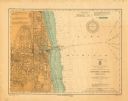
| Description: | This map is a survey of Kenosha Harbor and shows local streets, public buildings, local businesses, and part of Lake Michigan. Included is text on sailing ... |

| Date: | 1855 |
|---|---|
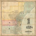
| Description: | This map shows lot and block numbers, buildings, some landownership, roads, railroads, cemeteries, the Milwaukee River, and Lake Michigan. The map includes... |

| Date: | 1915 |
|---|---|
| Description: | This map is mounted on cloth and shows lots and landownership, selected buildings, roads, railroads, parks, cemeteries, city wards, and includes advertisem... |

| Date: | 1987 |
|---|---|
| Description: | This pictorial map shows roads, bridges, local businesses with phone numbers, and public buildings. Relief is shown pictorially. Also included is a calen... |

| Date: | 1858 |
|---|---|
| Description: | This map is hand-colored and mounted on cloth and shows lot and block numbers and dimensions, landownership, streets, railroads, selected buildings, fair g... |

| Date: | 1883 |
|---|---|
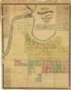
| Description: | This map shows ward boundaries, names of additions, streets, bridges, mills, schools, religious buildings, businesses, hotels, railroads, factories, brewer... |

| Date: | 1953 |
|---|---|
| Description: | This map shows local streets, roads, highways, Middleton, Monona, Lake Wingra, Lake Monona, Lake Mendota, and an inset map that shows city parking areas. A... |

| Date: | 1883 |
|---|---|
| Description: | This map shows lots, neighborhood additions and subdivisions (some in blue, green, pink, and yellow), and numbered wards. Streets, Lake Michigan, and the R... |

| Date: | 1968 |
|---|---|
| Description: | Three maps that show local streets, roads, railroads, parks, country clubs, the University of Wisconsin, Shorewood Hills, Maple Bluff, Monona, Truax Field,... |

| Date: | 1962 |
|---|---|
| Description: | This blue print map shows 5 zoning districts, as well as lot and block numbers and dimensions, public land, streets, and Mill Pond. The zones are: "Single ... |

| Date: | 1875 |
|---|---|
| Description: | This plat map shows local streets, buildings, numbered blocks and lots, part of the Red Cedar River, and land ownership by name. Also included is a busines... |

| Date: | 11 21 1950 |
|---|---|
| Description: | This map shows agricultural, residence, business, and industrial districts as well as lot and block numbers. |

| Date: | 1903 |
|---|---|
| Description: | This blue line print map is oriented with the north to the left and shows buildings with dimensions, utilities, and proposed buildings. The Flambeau River ... |

| Date: | 1857 |
|---|---|
| Description: | This map shows roads, railroads, lakes, and land ownership by name. Also included are illustrations of select business and residences, business directories... |

| Date: | 1860 |
|---|---|
| Description: | This map shows roads, trails, and railroads throughout Nebraska, Arkansas, Missouri, Kansas, Illinois, and Utah, including the Salt Lake City & California ... |

| Date: | 1903 |
|---|---|
| Description: | This map shows lakes, roads, railroads, townships, and land ownership by name. Counties are colored red, blue, or yellow. Lake Michigan is labeled. Also in... |
If you didn't find the material you searched for, our Library Reference Staff can help.
Call our reference desk at 608-264-6535 or email us at: