
| Date: | 1935 |
|---|---|
| Description: | This blue lined map shows the major roads and cities of Wisconsin. The map includes an index, hotel and cafe advertisements, as well as advertisements for ... |

| Date: | 1935 |
|---|---|
| Description: | This blue lined map ("compliments of Black Eagle Oil Company") shows the major roads and cities of Wisconsin. The map includes an index, hotel and cafe adv... |

| Date: | 1936 |
|---|---|
| Description: | This road map shows the major roads, cities, lakes, and rivers of Wisconsin and parts of the neighboring states and Canada, as well as advertisements for t... |

| Date: | 1975 |
|---|---|
| Description: | This map shows nature trails, public attractions, public hunting and fishing grounds, dams, waysides, lakes, highways, and roads. The upper right corner in... |

| Date: | 1943 |
|---|---|
| Description: | This map shows roads, trails, taverns, schools, golf, gas stations, campsites, resorts, and towers. The lower left of the map includes a legend. The map co... |
| Date: | 1991 |
|---|---|
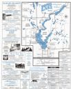
| Description: | This map shows public access, fish crib locations, resorts, and other local businesses as well as advertisements for local attractions and a resort index. ... |

| Date: | 1937 |
|---|---|
| Description: | This map shows the major roads, cities, towns, lakes, and rivers of Wisconsin and some of the neighboring states. The front includes an add for Coca-Cola, ... |
| Date: | 2004 |
|---|---|
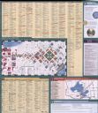
| Description: | This map shows ATMs, houses of worship, hotels, parking ramps, public parking, union cab stands, bus stops, business district, parks and public areas, gove... |

| Date: | 1937 |
|---|---|
| Description: | This cadastral map shows lots, streets, and Pell Lake. The back of the map includes a large advertisement for the Pell Lake Addition summer home lots. |

| Date: | 1927 |
|---|---|
| Description: | This map details automobile routes throughout the state as well as parts of Iowa, Minnesota, Michigan and Illinois. Cities, the Mississippi River, Lake Mic... |
| Date: | 1915 |
|---|---|
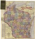
| Description: | This map includes automobile routes through the state as well as routes in parts of Iowa, Michigan and Minnesota. Cities, counties, Lake Michigan, Lake Sup... |
| Date: | 1900 |
|---|---|
| Description: | This photocopy map shows blocks, lots, subdivisions, city wards, buildings, some landownership, and the Mississippi River. The map margins include business... |
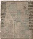
| Date: | 1864 |
|---|---|
| Description: | This map shows land owners, buildings, cities and villages, lakes, rivers, and roads. The margins include inset maps: Berlin; Mill Point; Holland; Ferrisvi... |

| Date: | 1929 |
|---|---|
| Description: | This map of the entire state includes portions of Illinois, Iowa, Michigan, and Minnesota. The map shows U.S., state, and county highways, roads, campsites... |

| Date: | 1920 |
|---|---|
| Description: | This map of the entire state shows state and other highways, cities, some lake, the Mississippi River, Lake Michigan, and Lake Superior. The bottom left co... |
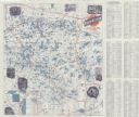
| Date: | 1922 |
|---|---|
| Description: | This map shows in red the NorthWestern Railway Line routes running from Chicago, Illinois to northern Wisconsin. The map includes cities and towns, lakes, ... |

| Date: | 1925 |
|---|---|
| Description: | The map shows the entire state with portions of Illinois, Iowa, Minnesota, and Michigan. The map shows concrete, gravel, all weather earth, clay, and sand ... |

| Date: | 1934 |
|---|---|
| Description: | This map provides automobile routes through Wisconsin along with portions of Illinois, Iowa, Minnesota and Michigan. Lake Superior, Lake Michigan, Green B... |
If you didn't find the material you searched for, our Library Reference Staff can help.
Call our reference desk at 608-264-6535 or email us at: