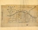
| Date: | 1829 |
|---|---|
| Description: | This map of Munnomonee is ink and pencil on tracing cloth. The map shows a plat of the town, local streets, highways, land donations for public use, and pa... |

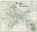
| Date: | 1974 |
|---|---|
| Description: | This map shows roads, highways, railroads, major arterials, towns, parks, recreational areas, and parts of Fox River and bay of Green Bay. The map includes... |

| Date: | 1950 |
|---|---|
| Description: | This map shows portions of highway remaining unchanged, proposed relocations, connecting county trunk roads existing or proposed, existing arterials, and e... |
If you didn't find the material you searched for, our Library Reference Staff can help.
Call our reference desk at 608-264-6535 or email us at: