| Date: | 1878 |
|---|---|
| Description: | Bird's-eye map of Kewaskum. Includes a list of hotels, churches, post office, railroad depot, etc. |

| Date: | 1866 |
|---|---|
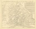
| Description: | This detailed map shows the positions of the armies of the Ohio and Tennessee, Confederate lines, headquarters, "regimental camps at the date of the battle... |

| Date: | 1950 |
|---|---|
| Description: | Aerial view of the Island City surrounded by the waters of Beaver Dam Lake, and by a vacation and recreation area that includes some fifty lakes within a r... |

| Date: | 1928 |
|---|---|
| Description: | Birds-eye view showing Lake Mendota, Lake Monona, Lake Wingra, Lake Waubesa and Lake Kegonsa. Shows the growth of Madison from the Isthmus along the southe... |
If you didn't find the material you searched for, our Library Reference Staff can help.
Call our reference desk at 608-264-6535 or email us at: