 Filter: Categories of Wisconsin Historical Images
Filter: Subject of Formations (Geology)
Filter: Type of Map or Atlas
Filter: Categories of Wisconsin Historical Images
Filter: Subject of Formations (Geology)
Filter: Type of Map or Atlas
| Date: | |
|---|---|
| Description: | Geological map. |

| Date: | 1900 |
|---|---|
| Description: | Hydrographic map of Lake Mendota and it's adjacent topography. Prepared from surveys made by civil engineering students, University of Wisconsin, classes 1... |

| Date: | 1839 |
|---|---|
| Description: | Shows locations of cities, towns, villages, post hamlets, canals, rail and stage roads. Includes table of steamboat routes and distances; vignette of "Maid... |

| Date: | 1887 |
|---|---|
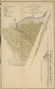
| Description: | Benedict & Co. engineers. As shown by development to March 1st 1887. Inset: Map of northern Wisconsin showing location of range. Lands in red. |

| Date: | |
|---|---|
| Description: | Map reads: "The United States from the Latest Authorities". View of the states and territories. |

| Date: | 1839 |
|---|---|
| Description: | Map of a canal route to avoid the principal rapids of the Neenah or Fox River between Lake Winnebago and Green Bay. |
| Date: | 1851 |
|---|---|
| Description: | Owen Geological Map of Wisconsin. |

| Date: | 1952 |
|---|---|
| Description: | The famous Dells of the Wisconsin River. A souvenir map embellished with bits of history and points of interest. |

| Date: | 1968 |
|---|---|
| Description: | This map shows lakes, rivers and soil types. Lake Michigan, Lake Superior, and portions of Illinois, Iowa, Michigan, and Minnesota are labeled. A legend to... |

| Date: | 1928 |
|---|---|
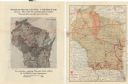
| Description: | This map shows geological formations throughout Wisconsin. Lakes and rivers are labeled, including The Mississippi River, Lake Superior, and Lake Michigan.... |

| Date: | 1920 |
|---|---|
| Description: | This map identifies the areas of the state that had been geologically surveyed or topographically surveyed, or both, as well as portions of the state still... |

| Date: | 1844 |
|---|---|
| Description: | A hand-colored map and chart showing a geological cross-section from Rockingham, in present-day Scott County, Iowa, through Blue Mounds to the Wisconsin Ri... |

| Date: | 1905 |
|---|---|
| Description: | A geological survey map of southeastern Wisconsin, showing Pleistocene-era deposits, including drifts, moraines, drumlins and deposits from various glacier... |

| Date: | 1852 |
|---|---|
| Description: | Hand-colored maps and a series of geological cross sections of the Mississippi River between the Falls of St. Anthony and the mouth of the Wisconsin River ... |
| Date: | 1910 |
|---|---|
| Description: | Two maps that show the rail lines of the Minneapolis, St. Paul & Sault Ste. Marie Railway Company in Wisconsin. The first map shows these lines on the Map ... |

| Date: | 1855 |
|---|---|
| Description: | This map shows counties, cities, rivers, canals, lakes, railroads, common roads, county towns, townships, villages, and post offices. The map includes part... |

| Date: | 1864 |
|---|---|
| Description: | A geological map of Wisconsin that shows the locations of different rock deposits such as limestone, sandstone, shale, plutonic and the Penokee Iron Range.... |

| Date: | 1882 |
|---|---|
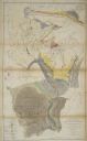
| Description: | A geological map of northern Wisconsin showing the locations of different soil types in the state such as sandy soil, sandy loam, prairie loam, clayey loam... |

| Date: | 1847 |
|---|---|
| Description: | A hand-colored map that shows the area south and east of the Wisconsin and Fox Rivers, as well as a few landmarks just north of that area. The township gri... |

| Date: | 1842 |
|---|---|
| Description: | This map shows portions of northern Illinois and Wisconsin surveyed by the map's creation. It shows county lines and university land, and depicts lead and ... |
If you didn't find the material you searched for, our Library Reference Staff can help.
Call our reference desk at 608-264-6535 or email us at: