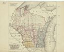
| Date: | 1920 |
|---|---|
| Description: | This map identifies the areas of the state that had been geologically surveyed or topographically surveyed, or both, as well as portions of the state still... |

| Date: | 1874 |
|---|---|
| Description: | A hand-colored, geological map of Wisconsin show the progress of the state geological survey in 1873 and 1874. Other elements displayed in the map include... |

| Date: | |
|---|---|
| Description: | A hand-colored geological cross section of Iowa County and eastern Dane County, Wisconsin, from the Blue Mounds north-northwest to the sandy plain of the W... |

| Date: | 1910 |
|---|---|
| Description: | This map shows the Soo Line railroad and Arpin Hardwood Lumber Company lands in red. The top margin of the map reads: "Wisconsin, the safest state in the U... |
If you didn't find the material you searched for, our Library Reference Staff can help.
Call our reference desk at 608-264-6535 or email us at: