| Date: | 1828 |
|---|---|
| Description: | Drawing by Increase Lapham showing the geological profile of the land between Utica and Knob Creek, Kentucky at a scale of 1/2 inch to a mile. |

| Date: | 1840 |
|---|---|
| Description: | This map is pencil on paper and shows rivers, granite locations, and selected landmarks. Relief is shown by hachures. |

| Date: | 1910 |
|---|---|
| Description: | This map shows the Soo Line railroad and Arpin Hardwood Lumber Company lands in red. The top margin of the map reads: "Wisconsin, the safest state in the U... |

| Date: | 1878 |
|---|---|
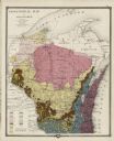
| Description: | This map shows geographic regions of the entire state. The bottom left corner includes an "Explanation of Color": Laurentien Granite (pink), Huronian Iron-... |
If you didn't find the material you searched for, our Library Reference Staff can help.
Call our reference desk at 608-264-6535 or email us at: