Filter: Categories of Wisconsin Historical Images
Filter: Subject of Indians of North America
Filter: Type of Drawing
Filter: Year of 1800-1899
Filter: Categories of Wisconsin Historical Images
Filter: Subject of Indians of North America
Filter: Type of Drawing
Filter: Year of 1800-1899
| Date: | 05 1849 |
|---|---|
| Description: | Deserted Pawnee village in Nebraska. Sketched by Wilkins on his 151-day journey from Missouri to California on the Overland Trail (also known as the Oregon... |

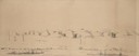
| Date: | 10 1852 |
|---|---|
| Description: | Landscape view of the river looking downstream from Fort Snelling, Minnesota Territory. An expanse of placid river water fills the center of the drawing an... |
| Date: | 1885 |
|---|---|
| Description: | Illustration of medicine man Jes´ akkid´ bending over an ill person, removing disease from his/her body. |

| Date: | 1852 |
|---|---|
| Description: | Illustration of four Indians on Madeline Island with a canoe in the water on the shore. |

| Date: | 1852 |
|---|---|
| Description: | An illustration of a storm encountered by a delegation of Indians on their way to Washington, D.C. |

| Date: | 07 1838 |
|---|---|
| Description: | A map diagram of Indian effigy mounds seven miles east of Blue Mounds in the Wisconsin Territory. |
| Date: | 1850 |
|---|---|
| Description: | Chippewa Indian Sugar Camp. Plate 61, preceding p. 199, vol. I, The Indian tribes of the United States: their history antiquities, customs, religion, ar... |

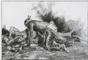
| Date: | 1840 |
|---|---|
| Description: | Photograph of a drawing of an Indian aiming his bow and arrow, with one foot standing on an earlier kill. |
| Date: | 07 25 1849 |
|---|---|
| Description: | Fort Bridger in Wyoming, with wagon parts and teepees, where Wilkins camped for a night; sketched by Wilkins on his 151-day journey from Missouri to Califo... |
| Date: | 1880 |
|---|---|
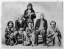
| Description: | Illustration of Winnebago (Ho-Chunk) men. One of them may be Yellow Thunder. |
| Date: | 09 1890 |
|---|---|
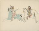
| Description: | Combat between a Comanche (left) and a Kiowa (right) done by a Comanche boy, at Kiowa, Comanche, and Wichita Agency, Oklahoma. |
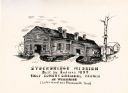
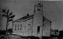
| Date: | 1835 |
|---|---|
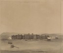
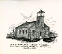
| Description: | Drawing of the Stockbridge Indian Mission, built in about 1834. |
| Date: | 1835 |
|---|---|
| Description: | Drawing of the Stockbridge Indian mission. |

| Date: | 1837 |
|---|---|
| Description: | Copy of N.F. Hyer's original map of Aztalan as published in the Milwaukee Advertiser, February 25, 1837. |
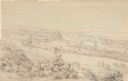
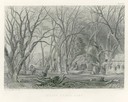
| Date: | 1852 |
|---|---|
| Description: | Landscape view of Fort Snelling, Minnesota Territory from a nearby hill showing the Fort, the Mississippi river, the countryside, farm buildings and tipis.... |

| Date: | 1806 |
|---|---|
| Description: | Prehistoric Indian fortification on Hurricane Creek. |
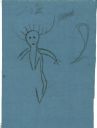
| Date: | 06 1879 |
|---|---|
| Description: | Tracing of a cave petroglyph depicting a human figure wearing headgear. A club is depicted to the right of the figure. |
| Date: | 06 1879 |
|---|---|
| Description: | Tracing of a petroglyph depicting an animal figure pursued by a human figure with a bow and arrow followed by a child. |

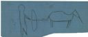
| Date: | 06 1879 |
|---|---|
| Description: | Tracing of a petroglyph depicting an animal that has been shot with an arrow. |
If you didn't find the material you searched for, our Library Reference Staff can help.
Call our reference desk at 608-264-6535 or email us at: