 Filter: Categories of Wisconsin Historical Images
Filter: Subject of Indians of North America
Filter: Type of Map or Atlas
Filter: Categories of Wisconsin Historical Images
Filter: Subject of Indians of North America
Filter: Type of Map or Atlas

| Date: | 1936 |
|---|---|
| Description: | This map shows the state trunk highway system and county trunk highways. This map show surface type on state and county trunk highways and the locations of... |

| Date: | 1939 |
|---|---|
| Description: | This map shows the state trunk highway system and county trunk highways. This map show surface type on state and county trunk highways and the locations of... |

| Date: | 1910 |
|---|---|
| Description: | This map shows the locations of school houses, farms, roads, railroads, and Bad River Indian Reservation. Relief is shown by hachures. Yellow and red manus... |

| Date: | 1975 |
|---|---|
| Description: | This map shows boundaries, roads, national forest land, bogs and wetlands, lakes, campgrounds, and boat landings. |

| Date: | 1910 |
|---|---|
| Description: | This blue print map shows original lakes, area to be covered by Chippewa Flowage (flow-lines for contours 1310 and 1315), dam sites, roads, and buildings. |

| Date: | 1907 |
|---|---|
| Description: | This blueprint map shows a proposed plan for pleasure roads and reservation system. It also shows schools, cemeteries, old river channel, proposed bridge, ... |

| Date: | 1937 |
|---|---|
| Description: | Pictorial map showing historical events and locations within the state of Wisconsin, as well as waterways and counties. Original caption on the bottom marg... |

| Date: | 1942 |
|---|---|
| Description: | This pictorial bird's-eye-view map shows the United States of America with parts of Canada and Mexico. Landscape, trade, industry, points of interest, peop... |

| Date: | 1946 |
|---|---|
| Description: | This map shows scenes from America's history with names of historical events superimposed on a map of the United States. |

| Date: | 1900 |
|---|---|
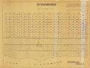
| Description: | This map shows landownership circa 1848 in the old Stockbridge Indian reservation on Lake Winnebago in Calumet County. It is oriented with north to the lef... |
| Date: | 1955 |
|---|---|
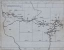
| Description: | This map shows landownership in the old Stockbridge Indian reservation on Lake Winnebago in Calumet County. The lots are numbered and labeled by owner. A b... |

| Date: | 1985 |
|---|---|
| Description: | This map shows mining, White River, Silver Creek, Bad River, Agogic Lake, Chequamegon Bay, smaller lakes, the Bad River Indian Reservation, and communities... |

| Date: | 1900 |
|---|---|
| Description: | This map shows the boundary lines between ceded and unceded land in compliance with the Treaty of Prairie du Chen of 1829. It also shows roads, rivers, por... |

| Date: | 1829 |
|---|---|
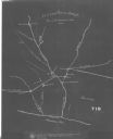
| Description: | This map shows waterways, trails, settlements, Indian villages, and boundaries. The map includes text in the lower left with excerpts from Indian land trea... |

| Date: | 1930 |
|---|---|
| Description: | This map shows rivers, lakes, trails, Indian villages, distances, and boundaries of tracts ceded by the Munnomonee, Winnebaygoes, and New York Indians Trib... |
| Date: | 1831 |
|---|---|
| Description: | This map was drawn by a Chippewa leader and shows the boundary lines between the Chippewa and Sioux territories and a saw-mill built by settlers without pe... |

| Date: | 2000 |
|---|---|
| Description: | This map shows national parks, county and state forests, Indian reservations, municipal land, private land, docks, boat access, camping, and points of inte... |
| Date: | 1949 |
|---|---|
| Description: | This map traces the route taken Chief Black Hawk from Vernon County, Wisconsin east to Waukesha County and south to Rock County, Wisconsin in 1832. Towns, ... |

| Date: | 1836 |
|---|---|
| Description: | This negative photostat map shows the "oak tree, place of beginning" on the division line between Stockbridge and Brothertown Indians, and Governor Porter'... |

| Date: | 1947 |
|---|---|
| Description: | This map shows the territories of Chippewa, Sioux, Winnebago, and Monomone tribes. It also shows navigation notes for rivers and lakes, Indian villages, hi... |
If you didn't find the material you searched for, our Library Reference Staff can help.
Call our reference desk at 608-264-6535 or email us at: