
| Date: | 1874 |
|---|---|
| Description: | Bird's-eye map of Chippewa Falls. |

| Date: | 1879 |
|---|---|
| Description: | This map is a bird's-eye view of Wausau, the County Seat of Marathon County. The map features an index of points of interest. |

| Date: | 02 26 1887 |
|---|---|
| Description: | Bird's-eye map of Ashland, and the Apostle Islands in Lake Superior. Caption reads: "Ashland and the Apostle Islands." |

| Date: | |
|---|---|
| Description: | Plat map of the east central part of the city. |

| Date: | 1761 |
|---|---|
| Description: | A plan of the Straits of St. Mary and Michilimakinac, to shew the situation and importance of the two westernmost settlements of Canada for the fur trade. ... |
| Date: | 1878 |
|---|---|
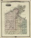
| Description: | A color map detailing Ashland and Bayfield counties, including Lake Superior and the Apostle Islands. |
| Date: | 1876 |
|---|---|
| Description: | This map is of the towns of Neenah and Menasha and shows existing and proposed canals. Water depths shown by soundings. Little Butte des Morts Lake, Doty I... |

| Date: | 1893 |
|---|---|
| Description: | This map of La Crosse shows wards 1-20, streets, railroads, the Inter State Fair Grounds, islands, and the Mississippi River. Relief is shown by hachures. ... |

| Date: | 1940 |
|---|---|
| Description: | This map of La Crosse shows different types of land zoning: residence, multiple dwelling, local business, commercial, light industrial, heavy industrial, w... |

| Date: | 1800 |
|---|---|
| Description: | This map of the Little Kaukalin Region is ink on paper and shows Little Kaukalin Rapids, Black Bird Island, buildings, trails, meadows and woods, and a sug... |
| Date: | 1836 |
|---|---|
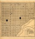
| Description: | This is a cadastral map and shows proposed lot and block numbers for a paper city on the banks of the Rock River. Also shown are two public squares and som... |

| Date: | 1857 |
|---|---|
| Description: | This map shows lot and block numbers, streets, railroad depots, locks, bridges, dams, canals, U.S. light house, college grounds, a steam boat landing, and ... |

| Date: | 1936 |
|---|---|
| Description: | This map shows campsites, trails, auto roads, surrounding townships, and points of interest, by including pictorial illustrations. Includes an inserted map... |

| Date: | 1776 |
|---|---|
| Description: | This was one of the first maps available for the general British populace featuring America during the Revolutionary War. It includes forts, cities, topogr... |
| Date: | 1782 |
|---|---|
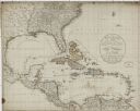
| Description: | Map of the West Indies and south eastern North America, remarkably detailed, showing cities, mountains, rivers, lakes, mines, plantations, forts, banks, an... |

| Date: | 1871 |
|---|---|
| Description: | A map of California showing railroad lines and reservations. |
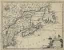
| Date: | 1755 |
|---|---|
| Description: | Map of the northeastern portion of America and Canada, east of the Hudson River and south from Labrador. It names regions, colonies, cities, numerous forts... |
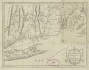
| Date: | 1780 |
|---|---|
| Description: | Map of Connecticut, Rhode Island, and Long Island. it shows the borders, cities, roads, islands, mountains, lakes and rivers. Navigational hazards along th... |
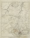
| Date: | 1780 |
|---|---|
| Description: | Map of New York and parts of the neighboring states. It shows cities, forts, towns, roads, mountains, lakes, and rivers. several different boundary lines a... |
If you didn't find the material you searched for, our Library Reference Staff can help.
Call our reference desk at 608-264-6535 or email us at: