| Date: | 02 26 1887 |
|---|---|
| Description: | Bird's-eye map of Ashland, and the Apostle Islands in Lake Superior. Caption reads: "Ashland and the Apostle Islands." |

| Date: | 1892 |
|---|---|
| Description: | Bird's-eye view of the Columbian Exposition pavilions from the vantage point of Lake Michigan. Included is an inset of the Union Passenger Station (now Uni... |

| Date: | 1844 |
|---|---|
| Description: | Map of Wisconsin including Lakes Michigan and Superior. Inset includes "N.W. Part of Wiskonsan." |

| Date: | 1820 |
|---|---|
| Description: | A manuscript map of Prairie du Chien. |

| Date: | |
|---|---|
| Description: | Plat map of the east central part of the city. |

| Date: | 1910 |
|---|---|
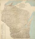
| Description: | Wisconsin Geological and Natural History Survey, by Lawrence Martin reproduced from a model of the state prepared by W.O. Hotchkiss and F.T. Thwaites and m... |

| Date: | 1828 |
|---|---|
| Description: | Plat of the Private Claims at Prairie Du Chien. |

| Date: | 1878 |
|---|---|
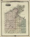
| Description: | A color map detailing Ashland and Bayfield counties, including Lake Superior and the Apostle Islands. |

| Date: | 1913 |
|---|---|
| Description: | A wall atlas of Sauk County, Wisconsin, displaying its 22 towns. On the left side are advertisements for local businesses. |

| Date: | 1981 |
|---|---|
| Description: | Plat map of Madeline Island surrounded by Basswood, Michigan and Gull Islands. |

| Date: | 1856 |
|---|---|
| Description: | A hand-colored map of Wisconsin, showing the county boundaries, towns, cities, railroads, roads, lakes, rivers, bays, and the Lake Superior’s islands. In ... |

| Date: | 1884 |
|---|---|
| Description: | A detailed, hand-colored map of Wisconsin and the western portion of Michigan’s Upper Peninsula, which also includes an inset of Isle Royale in Lake Superi... |

| Date: | 1915 |
|---|---|
| Description: | A map showing the location of post offices in Wisconsin and Michigan that were in operation as of April, 1915, along with the mail routes in use as well as... |

| Date: | 1881 |
|---|---|
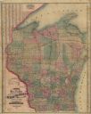
| Description: | A hand-colored, cloth mounted, sectional map of Wisconsin showing the township grid, completed and proposed railroads, counties, towns, cities, villages. T... |

| Date: | 1882 |
|---|---|
| Description: | A hand-colored, sectional map of Wisconsin showing the township grid, completed and proposed railroads, counties, towns, cities, villages. The map also inc... |

| Date: | |
|---|---|
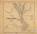
| Description: | A map of La Crosse, Wisconsin and La Crescent, Minnesota, showing sectional divisions along the shore and islands of the Mississippi River. The areas also ... |
If you didn't find the material you searched for, our Library Reference Staff can help.
Call our reference desk at 608-264-6535 or email us at: